
Product
D-RTK 3 Multifunctional Station
DJI · AIQ-0005
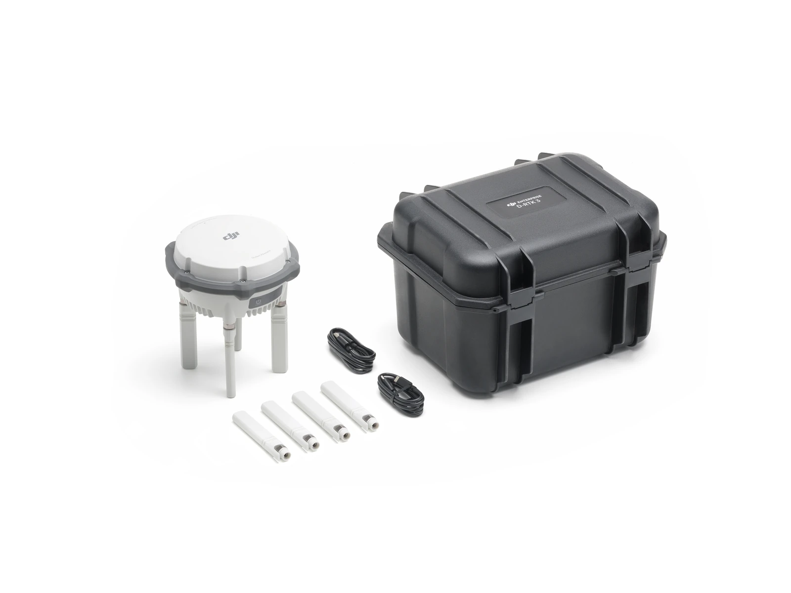
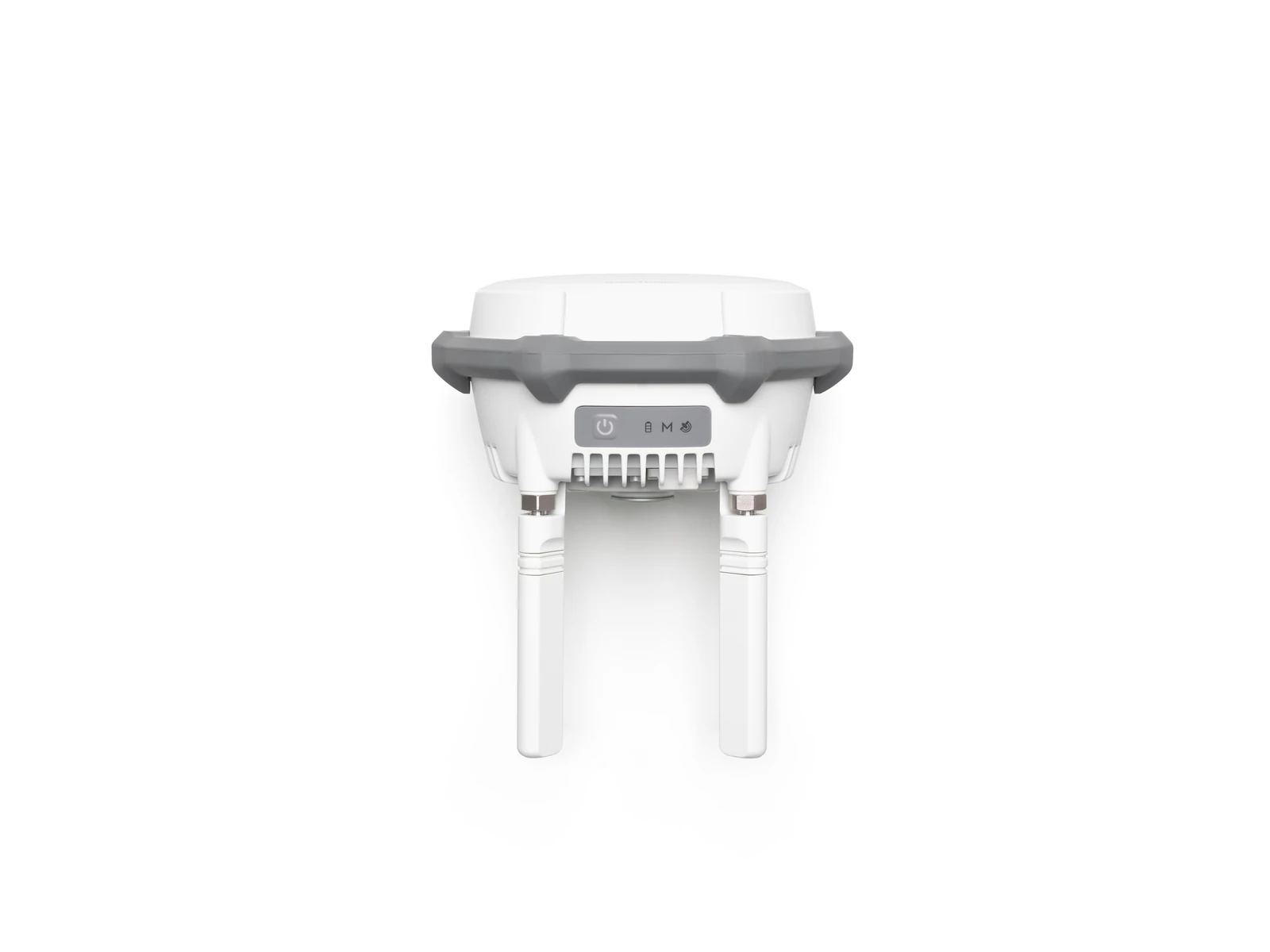
Centimetre-level RTK positioning, multi-constellation GNSS tracking and Base Station, Rover and Relay operating modes, combined in a rugged positioning system designed for professional drone surveying and geospatial workflows. The DJI D-RTK 3 Multifunctional Station can provide high-precision positioning to multiple compatible DJI aircraft, measure ground control points in the field and extend communications where terrain or obstructions affect the direct connection.
- Positioning accuracy0.8 cm RMS + 1 ppm
- Operating modesBase · Relay · Rover
- Range to Matrice 40040 km
- WeightApprox. 1.26 kg
- Ingress protectionIP67
Overview
About this product.
The DJI D-RTK 3 Multifunctional Station is a high-precision GNSS and RTK positioning solution designed to support professional surveying, mapping and enterprise drone operations. High-performance antennas and receiver modules track major global satellite navigation systems, allowing the station to provide centimetre-level positioning information for compatible DJI aircraft and improve the accuracy and repeatability of aerial data capture.
Unlike a conventional RTK base station, the D-RTK 3 can operate in three different configurations. Broadcast Mode allows it to function as a base station for multiple DJI aircraft, Rover Station Mode turns it into a handheld surveying tool for measuring control points, and Relay Station Mode allows it to be positioned in an elevated location to improve communications where terrain, structures or other obstacles block the direct signal.
For surveying and geospatial teams, this means a single unit can support both the aerial and ground components of a mapping workflow. Control points collected in Rover Station Mode can be exported for use with DJI Terra, while raw satellite observation data recorded by the station can also be imported into DJI Terra for PPK processing.
High-Precision RTK Positioning
- Centimetre-Level Base Station Positioning: When calibrated using Network RTK, the D-RTK 3 provides base station accuracy of 1.0 cm + 1 ppm horizontally and 3.0 cm + 1 ppm vertically under DJI's stated conditions.
- Multi-Constellation GNSS Receiver: Supports signals from GPS, BeiDou, Galileo, GLONASS and QZSS, providing access to multiple satellite constellations for reliable positioning in professional field operations.
- Multiple Aircraft Support: In Broadcast Mode, one D-RTK 3 can provide positioning data to multiple compatible DJI aircraft at the same time, making it suitable for organisations operating more than one drone from the same site.
- Network RTK Calibration: Base station coordinates can be established through Network RTK calibration, satellite-based PPP calibration or manual coordinate entry depending on the project and available positioning infrastructure.
- Raw Observation Data: The station records RTCM 3.2 raw observation information in DAT format when operating as a base or relay station, supporting post-processed workflows where required.
Three Operating Modes
- Broadcast Mode: Use the D-RTK 3 as an RTK base station to provide accurate correction data for centimetre-level positioning across multiple compatible DJI aircraft.
- Rover Station Mode: Use the station as a handheld GNSS rover to measure control points and other survey positions directly on the ground.
- Relay Station Mode: Position the D-RTK 3 at an elevated location and use it as a communications relay between a compatible aircraft and remote controller or DJI Dock 3, helping overcome signal obstruction.
- Simple Mode Switching: Operating modes can be changed using the station controls, DJI Pilot 2 or DJI Assistant 2 Enterprise Series depending on the workflow.
Rover Surveying and Ground Control
- High-Precision Rover Measurements: Fixed RTK surveying provides stated accuracy of 0.8 cm + 1 ppm horizontally and 1.5 cm + 1 ppm vertically under DJI's specified conditions.
- Tilt Compensation: Survey points can be measured without keeping the pole perfectly vertical, with tilt compensation supporting angles from 0° to 60° and horizontal accuracy of less than 2 cm within 30° under the stated conditions.
- DJI Enterprise App Integration: Rover Station Mode works with the DJI Enterprise app for point collection, coordinate management and connection to an NTRIP network RTK service.
- Control Point Export: Surveyed control points can be exported from the DJI Enterprise app in formats compatible with DJI Terra, including JSON and CSV outputs.
- Coordinate Conversion: Built-in coordinate conversion allows rover measurements to be converted into standard projection formats for use within surveying and mapping workflows.
- DJI Terra PPK Support: Raw satellite observation data from the D-RTK 3 can be imported into DJI Terra version 4.4.0 and later for PPK processing.
Relay Station and Extended Operations
- O4 Enterprise Transmission: Relay Station Mode uses DJI's O4 Enterprise transmission system to support communications between compatible aircraft and their controller or Dock infrastructure.
- Overcome Signal Obstructions: Installing the station on a rooftop, tower or other elevated location can help maintain communications where mountains, buildings, trees or other obstacles interfere with a direct connection.
- Extended Relay Coverage: DJI states that relay deployment can provide a 3× to 5× performance improvement in severely obstructed environments and a 1× to 3× improvement with milder obstructions under its specified conditions.
- DJI Dock 3 Support: Relay functionality can also be used within compatible DJI Dock 3 deployments to improve communications in locations where the Dock cannot maintain an ideal direct connection with the aircraft.
Built for Professional Field Use
- IP67 Protection: The D-RTK 3 Multifunctional Station carries an IP67 protection rating under DJI's stated test conditions, supporting field use around dust, moisture and changing weather.
- Integrated Battery: A built-in 6500 mAh, 46.8 Wh LiPo battery provides up to 7 hours of operation in Base Station Mode, up to 10 hours in Rover Station Mode and up to 4 hours in Relay Station Mode under normal-temperature test conditions.
- USB-C Power: The station supports USB PD 3.0 power through USB-C, allowing it to be powered or charged from compatible field power equipment.
- Portable Design: At approximately 1.26 kg, the Multifunctional Station is designed to move between base station, rover and relay applications as project requirements change.
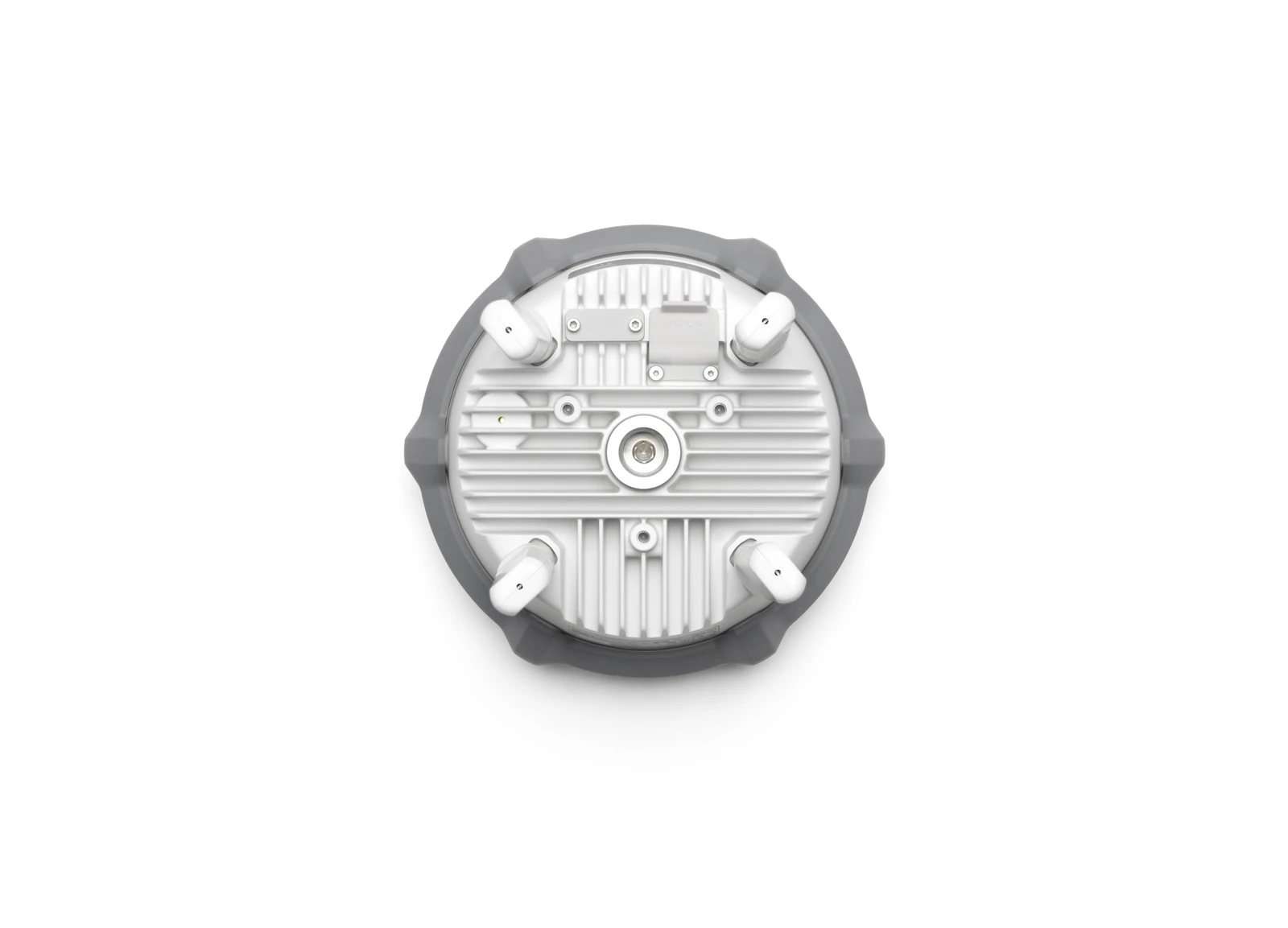
- Survey Pole Compatibility: A standard 5/8"-11 UNC thread allows the unit to be mounted to compatible professional survey poles and tripods.
Key capabilities
- Operating Modes: Base Station/Broadcast, Rover and Relay Station
- GNSS: GPS, BeiDou, Galileo, GLONASS and QZSS
- Base Station Accuracy with Network RTK Calibration: 1.0 cm + 1 ppm horizontal / 3.0 cm + 1 ppm vertical
- Rover RTK Accuracy: 0.8 cm + 1 ppm horizontal / 1.5 cm + 1 ppm vertical
- Tilt Survey: Up to 60° tilt compensation
- Aircraft Connections: Multiple compatible DJI aircraft simultaneously in Broadcast Mode
- Transmission System: O4 Enterprise
- Protection Rating: IP67
- Battery: Integrated 6500 mAh, 46.8 Wh LiPo
- Software Integration: DJI Pilot 2, DJI Enterprise app and DJI Terra
Typical applications
Drone surveying and mapping, establishing local RTK corrections, topographic surveys, construction and earthworks measurement, ground control point collection, cadastral and land surveying, LiDAR and photogrammetry projects, PPK workflows, infrastructure mapping and operations where terrain or structures affect aircraft communications. The DJI D-RTK 3 Multifunctional Station is particularly useful for surveying teams that want one RTK system to support both their drone and field workflows. Rather than operating solely as a DJI drone base station, it can move between providing centimetre-level corrections to aircraft, collecting control points as a GNSS rover and extending communications as a relay, reducing the need for separate equipment across different stages of an aerial surveying project.
Technical data
Specifications.
| Positioning | |
|---|---|
| Positioning accuracy (horizontal, fixed survey) | 0.8 cm RMS + 1 ppm |
| Positioning accuracy (vertical, fixed survey) | 1.5 cm RMS + 1 ppm |
| GNSS systems | GPS · BDS · Galileo · GLONASS · QZSS · L-Band |
| Operating modes | Base · Relay · Rover |
| Transmission | |
| Range to Matrice 400 (IC) | 40 km |
| Range to Matrice 400 (SRRC/CE/JP) | 20 km |
| General | |
| Battery life (rover / base / relay) | 10 / 7 / 4 h |
| Weight | Approx. 1.26 kg |
| Ingress protection | IP67 |
| Operating temperature | -20 to 55 °C |

Talk to AeroIQ