
INDUSTRY · Asset Management
Aerial Asset Intelligence for Safer, Faster and More Defensible Maintenance Decisions
Decision-ready asset data: accurate, repeatable and engineering-aligned, supporting inspections, condition assessment, lifecycle planning and compliance reporting.
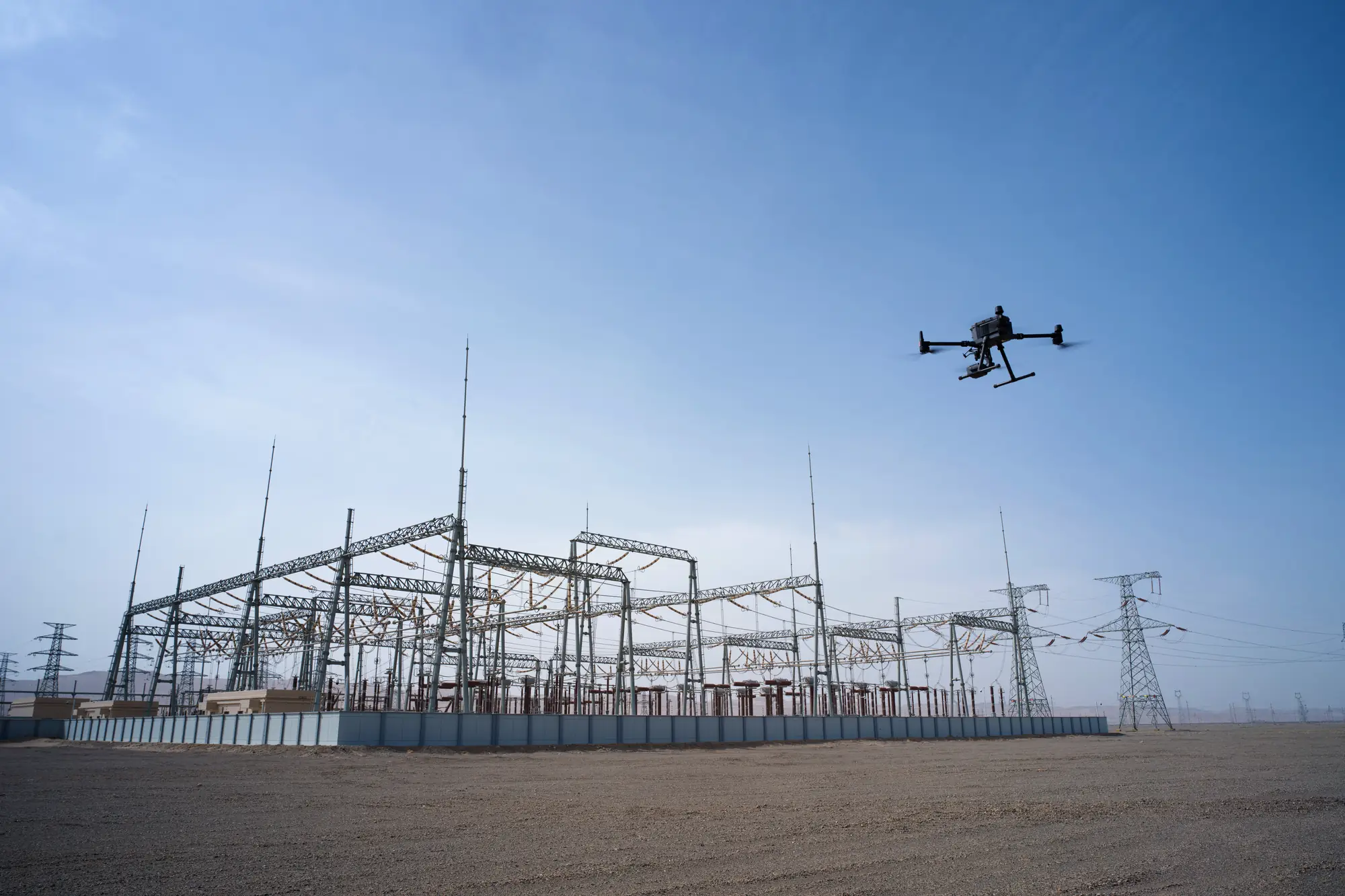
Why drones
50–90%
FASTER INSPECTION COVERAGE
- More complete visibility across large, distributed or difficult-to-access assets
- Safer operations: reduced exposure to heights, traffic, confined spaces and live infrastructure
- Repeatable imagery and measurements for consistent condition comparison over time
- Asset-linked evidence for defects, anomalies, clearances, geometry and surrounding hazards
- Faster identification of high-risk findings requiring specialist investigation
- Better prioritisation of inspection, maintenance and renewal resources
- Reduced dependence on scaffolding, elevated platforms, lane closures and shutdowns
- Stronger audit trails for contractor performance, compliance and lifecycle planning
Drones don’t replace asset managers. They amplify them.
Key use cases
Where drone asset management earns its place.
01
Asset inventory & baseline capture
Georeferenced imagery, mapping and LiDAR establish a current record of assets, structures, access routes and surrounding constraints. Capture confirms asset location, configuration and visible attributes, identifies missing or duplicated records and creates a reliable baseline for future inspection and change analysis.
ASSET LOCATIONS · HIGH-RESOLUTION IMAGERY · ORTHOMOSAICS · 3D CONTEXT · ATTRIBUTE VERIFICATION
02
Digital twins
Photogrammetry and LiDAR produce detailed 3D models and point clouds that integrate into asset registers, BIM systems and digital-twin environments. These datasets support asset verification, modelling and long-term planning.
3D MESHES · POINT CLOUDS · CAD-READY SURFACES
03
Visual condition & defect inspection
Close-range RGB and zoom imagery supports inspection of roofs, facades, bridges, towers, tanks, pipework, plant and elevated equipment. Findings such as corrosion, coating loss, cracking, loose components, seal failure, damage and vegetation interference can be linked to the correct asset and component for qualified review.
ASSET-LINKED IMAGES · DEFECT LOCATIONS · COMPONENT REFERENCES · CONDITION CLASSIFICATIONS
04
Vegetation encroachment & clearance checks
LiDAR and RGB imagery identify vegetation height, proximity and encroachment around critical assets. These layers support clearance planning, hazard reduction and compliance with regulatory vegetation standards.
LIDAR POINT CLOUDS · VEGETATION LAYERS · ENCROACHMENT MAPS
05
Structural & dimensional assessment
Photogrammetry and LiDAR create measurable 3D records of structures and surrounding geometry. Fit-for-purpose workflows support dimensions, clearances, alignment, surface condition, deformation screening and comparison against baseline or design data.
POINT CLOUDS · 3D GEOMETRY · DIMENSIONS · CLEARANCES · ALIGNMENT CHECKS
06
Roof, facade & building envelope
Drones capture inaccessible roof and facade areas without requiring immediate rope access or scaffolding. Visual and thermal evidence supports screening for membrane damage, failed flashings, drainage issues, sealant deterioration, cracking, glazing concerns and envelope heat or moisture anomalies.
ROOF & ELEVATION IMAGERY · DEFECT MAPS · THERMAL LAYERS · ANNOTATED ELEVATIONS
07
Roads, bridges & civil structures
Aerial inspection supports bridges, culverts, retaining structures, roads, slopes, drainage assets and other civil infrastructure. Drones improve visual coverage, site context and hazard documentation while reducing inspector exposure to traffic, water and steep terrain.
STRUCTURAL IMAGERY · SURFACE & DRAINAGE CONDITION · DEFECT LOCATIONS · CORRIDOR MODELS
08
Industrial, utility & hard-to-reach assets
Tanks, stacks, pipe racks, processing plant, cranes, towers and utility equipment often require expensive access arrangements. Drones provide rapid visual, thermal and dimensional screening so shutdowns and specialist access can be targeted around defined findings.
COMPONENT IMAGERY · CORROSION RECORDS · THERMAL ANOMALIES · GEOMETRY & ACCESS PLANNING
09
Construction, renewal & as-built verification
Repeat capture documents construction progress, renewal works, installed configuration and completed condition. Orthomosaics, 3D models and measurements can be compared with design information to identify exceptions, confirm quantities and preserve evidence before work is concealed.
PROGRESS RECORDS · AS-BUILT MODELS · MEASURED VARIANCE · INSTALLATION VERIFICATION
10
Emergency & post-event assessment
After storms, earthquakes, fire, flooding, slips or impact, drones rapidly establish the location and extent of visible damage without requiring personnel to enter every affected area.
DAMAGE MAPS · INACCESSIBLE AREAS · HAZARD IDENTIFICATION · THERMAL INTELLIGENCE
11
Thermal & moisture anomaly detection
Radiometric thermal data identifies temperature patterns associated with electrical heating, insulation loss, moisture, friction, process variation or other abnormal conditions. Environmental factors and operating state must be recorded, and findings confirmed by a qualified person.
RADIOMETRIC THERMAL IMAGERY · TEMPERATURE DIFFERENTIALS · ANOMALY LOCATIONS
12
Environmental & compliance monitoring
Aerial layers support erosion checks, sediment control, stormwater compliance and environmental reporting. Repeatable datasets provide defensible evidence for audits and regulatory submissions.
ORTHOMOSAICS · NDVI · DSM · CHANGE DETECTION
Deliverables
Drone data outputs.
A suite of asset-management-ready deliverables that traditional field-only methods cannot match for speed, resolution or completeness.
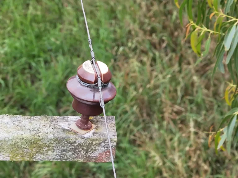
High-Resolution Imagery
RGB and zoom imagery linked to asset, component, location and inspection metadata
Used for
- Condition inspection
- remote review
- contractor assurance
- audit trails
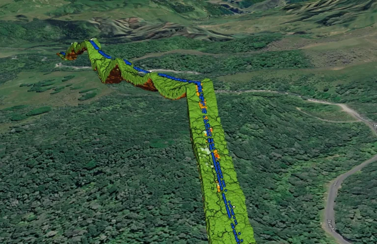
Defect Maps & Condition Ratings
Mapped defects and condition classes using approved terminology and thresholds
Used for
- Risk screening
- maintenance prioritisation
- inspection planning
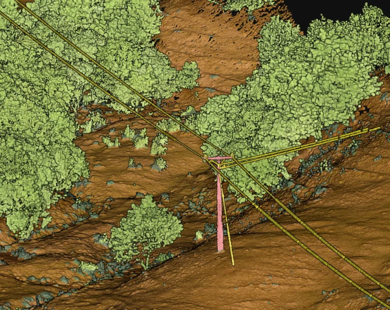
Classified LiDAR Point Clouds
Georeferenced 3D points representing assets, terrain and constraints
Used for
- Geometry
- clearances
- deformation screening
- digital-model workflows
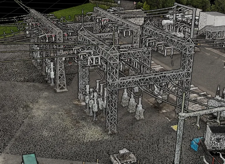
3D Models & Digital Twin Inputs
Photogrammetric meshes and point clouds aligned to asset information models
Used for
- Visualisation
- planning
- digital twins
- lifecycle information management
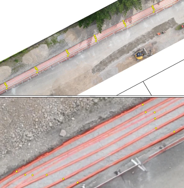
Orthomosaics & Site Base Layers
Georeferenced visual layers for assets, roads, drainage, boundaries and hazards
Used for
- Inventory
- access planning
- site coordination
- emergency response
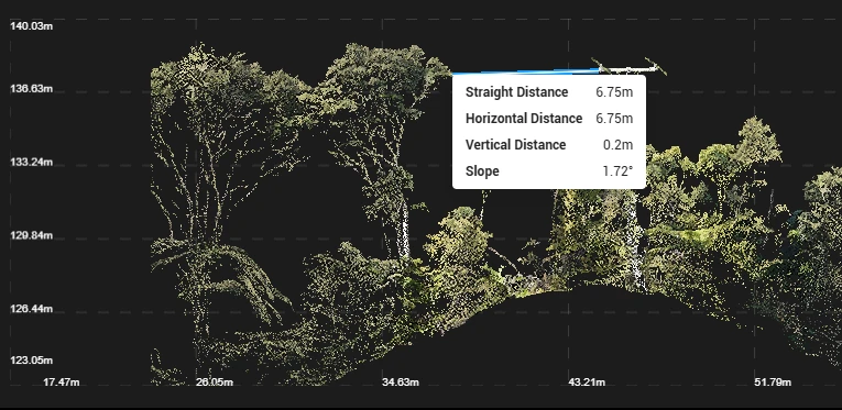
Measurements, Clearances & Geometry Reports
Validated dimensional checks with method, tolerance, confidence and status
Used for
- Clearance checks
- alignment
- deformation screening
- construction tolerance
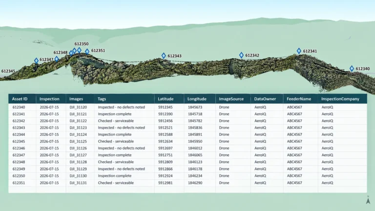
Maintenance Work Packs & Operational Registers
Structured datasets linking findings to asset ID, priority, evidence and required action
Used for
- Maintenance planning
- work-order creation
- contractor instructions
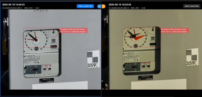
Repeat Capture & Change Detection
Time-series comparisons of imagery or LiDAR showing deterioration or change
Used for
- Condition trending
- verification
- renewal assurance
- lifecycle evidence
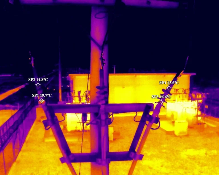
Radiometric Thermal Data
Temperature-retaining thermal files with environmental and operating-state metadata
Used for
- Electrical inspection
- building-envelope screening
- mechanical/process monitoring
Getting it right
Data quality and asset referencing.
Drone data must be reliable enough for the decision it supports. A sharp image or detailed model has limited value if it is linked to the wrong asset, lacks scale, omits a critical surface or cannot be compared with the approved inspection standard.
- Defined inspection question, output specification and acceptance criteria
- Correct asset hierarchy, site, route, structure, component and work-order naming
- RTK/PPK positioning and survey control where spatial accuracy is required
- Capture geometry, resolution, overlap, stand-off distance and viewing angles suited to the defect or measurement
- Consideration of lighting, temperature, weather, operating state, reflectivity and emissivity
- Reference measurements, checkpoints, drawings or physical observations for calibration
- AI/classification models validated for the relevant asset type and condition
- Coverage, focus, image quality, thermal quality, point density and completeness checks
- Documented coordinate systems, processing settings, thresholds, tolerances and model versions
- Clear communication of accuracy, confidence, assumptions, limitations and required physical confirmation
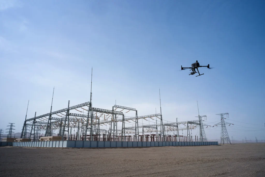
Fit for purpose, not one standard for every asset.
A roof defect, thermal anomaly, bridge clearance and deformation check each require different sensors, resolution, access, accuracy and review workflows.
Fits the systems you already run.
Outputs arrive clean, structured and asset-management-ready.
GIS
ArcGIS · QGIS · web-based asset mapping
ASSET & MAINTENANCE SYSTEMS
EAM · CMMS · work-order · inspection · condition-management platforms
ENGINEERING SYSTEMS
CAD · BIM · IFC · digital twins · common data environments
FIELD OPERATIONS
mobile GIS · inspection forms · contractor work packs
PHOTOGRAMMETRY
DJI Terra · Pix4D · RealityCapture · Agisoft Metashape
LIDAR
DJI Terra · TerraScan · CloudCompare
Products
Systems & equipment for Asset Management
Drones
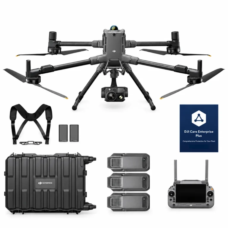
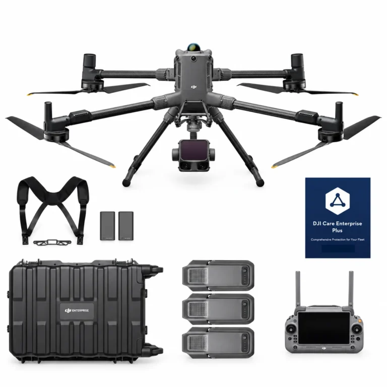
DJI Matrice 400 H30T Combo
AIQ-0102
48MP wide-angle camera, 40MP zoom camera with 34× hybrid optical zoom, 1280 × 1024 radiometric thermal imaging, NIR illumination and a laser range finder with up to 3,000 m measurement range, paired with the long-endurance DJI Matrice 400 enterprise platform. The Matrice 400 H30T Combo includes the Zenmuse H30T and three aircraft batteries, creating a powerful solution for asset inspection, energy and utilities, infrastructure, public safety and demanding day or night operations.
DJI Matrice 400 L3 Combo
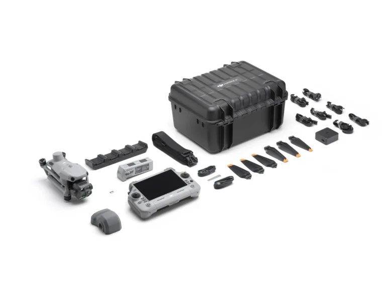
AIQ-0100
1535 nm long-range LiDAR, dual 100MP RGB mapping cameras and a high-precision POS system, paired with the long-endurance DJI Matrice 400 enterprise platform for high-efficiency geospatial data capture. The Matrice 400 L3 Combo includes the Zenmuse L3 and three aircraft batteries, creating a complete solution for large-area surveying, corridor mapping, forestry and infrastructure projects.
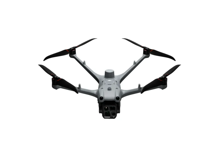
DJI Matrice 4T Essentials Combo
AIQ-0091
Compact enterprise drone for asset inspection, thermal imaging and situational awareness, combining wide-angle, medium telephoto, telephoto and radiometric thermal cameras with an integrated laser range finder. Long-range visual imaging, thermal data, low-light capability and intelligent flight tools support asset management, energy, utilities and infrastructure inspection workflows.
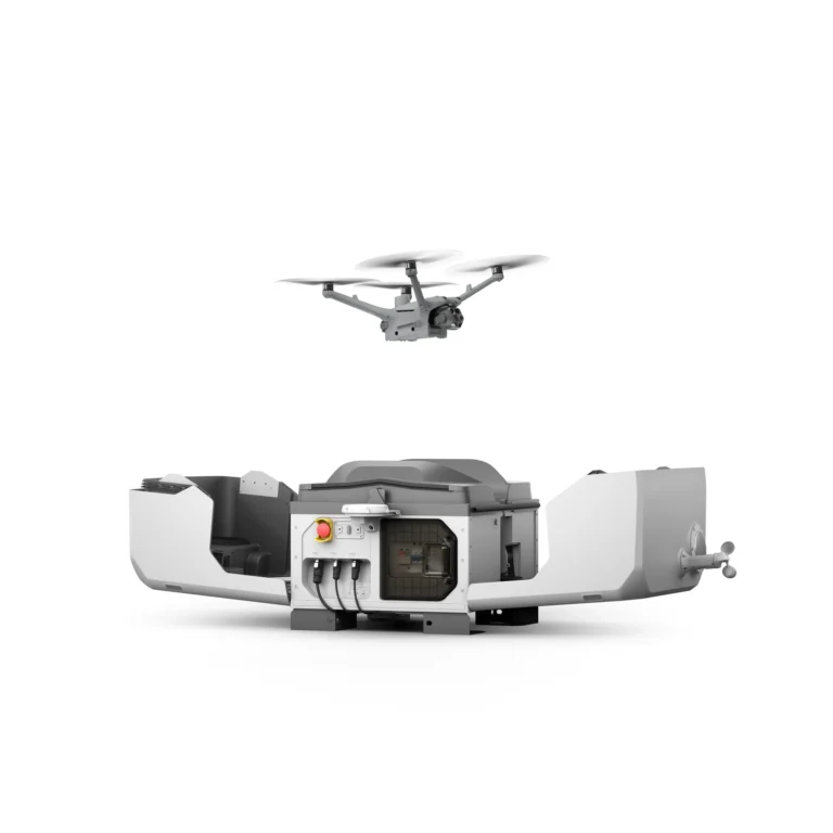
DJI Matrice 4TD Essentials Combo
AIQ-0097
48MP wide-angle, medium telephoto and telephoto cameras, combined with a radiometric thermal camera, NIR auxiliary light and laser range finder in a weather-resistant enterprise drone built for professional inspection and asset management. DJI Dock 3 compatibility, low-light imaging and long-range visual and thermal capture support repeatable energy, utilities, infrastructure and remote inspection workflows.
Dock Systems
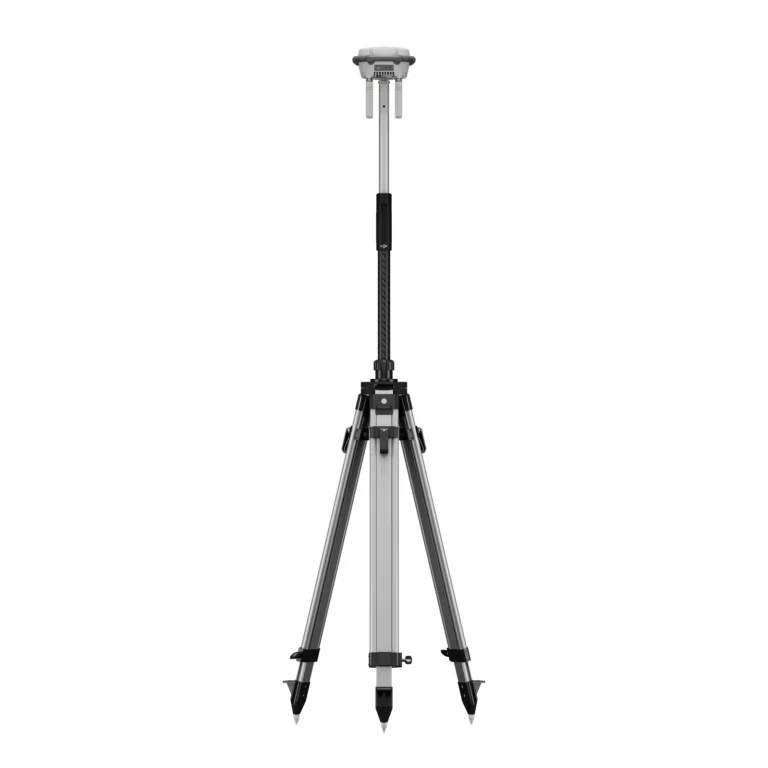
Accessories & Parts
Our services
How AeroIQ helps in this sector
Drone Consulting
Plan the right drone programme, workflows, governance and technology pathway from the start.
Drone Training
Build internal pilot capability through practical training, coaching and real-world operating scenarios.
Drone Hardware
Choose, configure and validate drone hardware, sensors and software so it works from day one.

Let’s talk