
INDUSTRY · Energy & Utilities
Aerial Intelligence for Safer, Smarter and More Resilient Networks
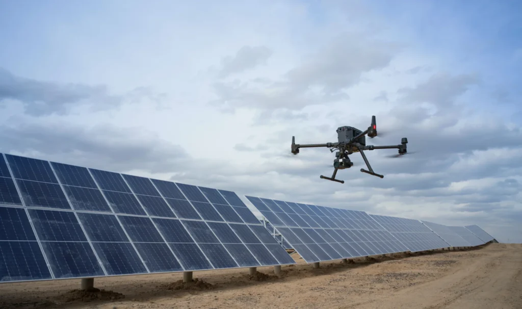
Decision-ready aerial data for condition assessment, vegetation management, engineering, fault response and long-term network planning.
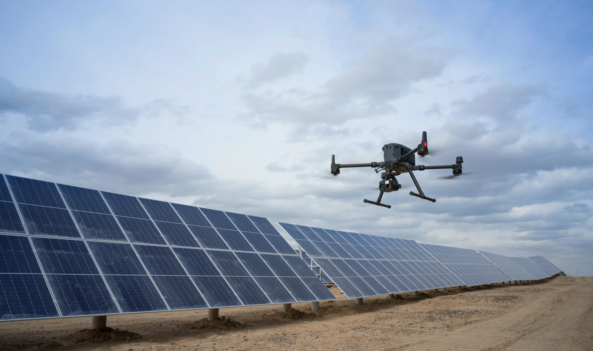
Why drones
Reduced exposure to high-risk field work
- Repeatable automated image capture for asset inspections
- Pre-emptive information for smarter decisions and a more resilient network
- Digital twins for asset management and site planning
- High-resolution inspections without routine climbing or elevated work
- Asset-linked visual evidence for remote engineering review
- LiDAR for conductor, clearance, terrain and vegetation analysis
- Faster situational awareness after storms, slips and faults
- Better targeting of crews, inspections and vegetation work
- Integration with GIS, asset management and work-order systems
- Scalable field, specialist and remote operations
Drones don’t replace network teams. They amplify them.
Key use cases
Where drones earn their place in energy networks.
01
Pole-top & overhead asset inspection
Consistent zoom imagery documents poles, crossarms, insulators, connectors, switches, transformers and conductor attachments. Asset-linked capture supports condition assessment and remote engineering review while reducing routine climbing.
RGB IMAGERY · COMPONENT VIEWS · ASSET-LINKED EVIDENCE
02
LiDAR corridor & clearance analysis
LiDAR captures conductors, structures, terrain and vegetation in 3D for span geometry, clearance measurement, encroachment identification and corridor-wide engineering review.
POINT CLOUDS · SPAN PROFILES · CLEARANCE EXCEPTIONS
03
Vegetation & treefall risk
LiDAR and imagery support vegetation proximity, growth and treefall-risk analysis, helping prioritise spans and plan risk-based trimming programmes.
VEGETATION RISK LAYERS · PRIORITY SPANS · WORK PACKAGES
04
Substation & facility inspection
Repeatable missions capture difficult-to-view substation structures and assets, improving condition comparison and pre-work planning beyond ground-level photography.
VISUAL & THERMAL IMAGERY · SITE MODELS · CONDITION RECORDS
05
Digital twin models for pre-work planning
Photogrammetry and LiDAR produce measurable 3D models of substations, poles, spans, switchyards and surrounding terrain. These digital-twin inputs give engineers and field crews a complete spatial understanding of the site before stepping foot on it: identifying hazards, access constraints, equipment layout, conductor geometry and work zones in advance.
3D MODELS · POINT CLOUDS · SITE GEOMETRY · ACCESS & HAZARD LAYERS
06
Storm & fault response
Drones rapidly document storm or fault damage, access constraints and vegetation strikes, supporting safer access planning and restoration prioritisation.
RAPID IMAGERY · DAMAGE LOCATIONS · ACCESS MAPS
07
Radiometric thermal inspection
Radiometric thermal imagery helps qualified reviewers identify abnormal heating in connectors, switches, transformers and substation equipment under suitable operating conditions.
THERMAL IMAGERY · TEMPERATURE DATA · ANOMALY RECORDS
08
Remote & docked operations
Docked systems support scheduled and remotely supervised capture at priority sites, reducing travel, speeding event response and making repeatable evidence available sooner.
SCHEDULED DATASETS · EVENT IMAGERY · MISSION RECORDS
Deliverables
Drone data outputs.
Structured network-ready evidence for engineering, maintenance and operational decisions.
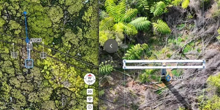
Asset-Linked High-Resolution Imagery
Standardised imagery linked to asset ID, location, timestamp and view
Used for
- Pole-top inspection
- condition assessment
- engineering review
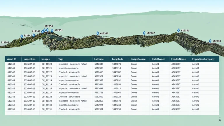
Defect Registers & Maintenance Priorities
Reviewed findings linked to asset, component, severity and evidence
Used for
- Condition assessment
- maintenance planning
- audit trails
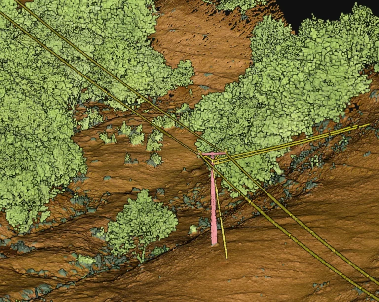
Classified LiDAR Point Clouds
Classified 3D points for conductors, ground, structures and vegetation
Used for
- Corridor modelling
- clearance
- terrain and vegetation analysis
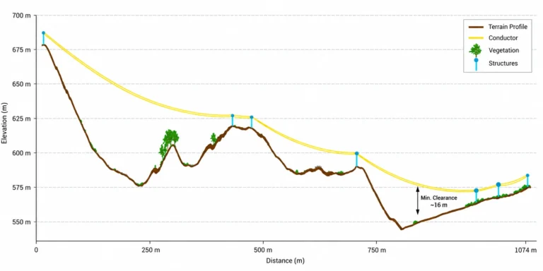
Clearance, Sag & Encroachment Reports
Span measurements of conductor geometry, clearances and exceptions
Used for
- Engineering review
- exception management
- field validation
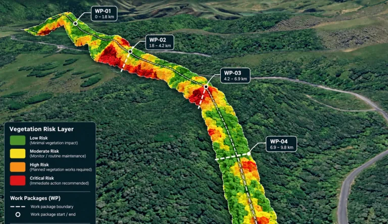
Vegetation Risk Layers & Work Packages
GIS layers linking vegetation issues to spans, evidence and priority
Used for
- Trim planning
- contractor work packs
- risk-based vegetation work
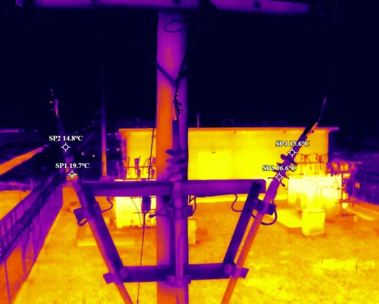
Radiometric Thermal Data
Thermal files preserving temperature data for detailed review
Used for
- Thermal screening
- substation inspection
- maintenance prioritisation
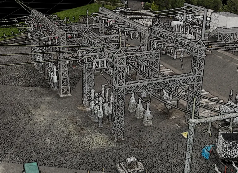
Orthomosaics & Site Models
High-resolution georeferenced site maps and visual base layers
Used for
- Substations
- projects
- incident mapping and planning
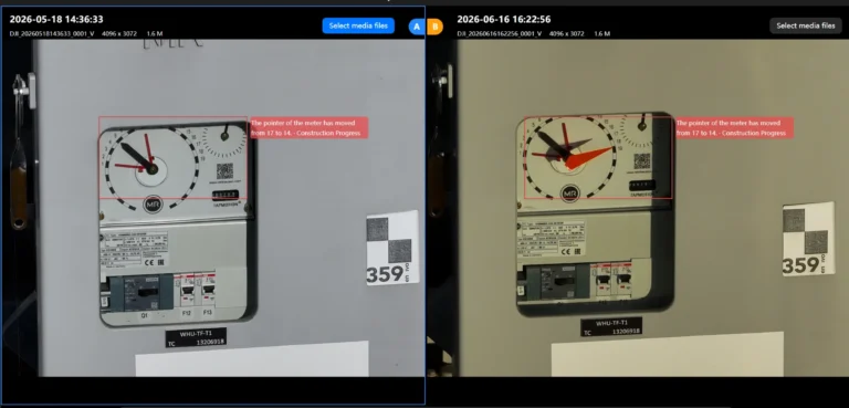
Repeat Capture & Change Detection
Repeat mission comparisons showing condition or network change
Used for
- Trending
- vegetation growth
- post-maintenance checks
- escalation
Getting it right
Data quality and asset referencing.
Drone data must be reliable enough for the decision it supports. A sharp image or detailed model has limited value if it is linked to the wrong asset, lacks scale, omits a critical surface or cannot be compared with the approved inspection standard.
- Defined inspection question, output specification and acceptance criteria
- Correct asset hierarchy, site, route, structure, component and work-order naming
- RTK/PPK positioning and survey control where spatial accuracy is required
- Capture geometry, resolution, overlap, stand-off distance and viewing angles suited to the defect or measurement
- Consideration of lighting, temperature, weather, operating state, reflectivity and emissivity
- Reference measurements, checkpoints, drawings or physical observations for calibration
- AI/classification models validated for the relevant asset type and condition
- Coverage, focus, image quality, thermal quality, point density and completeness checks
- Documented coordinate systems, processing settings, thresholds, tolerances and model versions
- Clear communication of accuracy, confidence, assumptions, limitations and required physical confirmation
Fits the systems you already run.
Outputs arrive clean, structured and network-ready.
GIS
Esri · ArcGIS · QGIS
ASSET & WORK MANAGEMENT
SAP · Maximo · Nera
ENGINEERING
Civil 3D · 12d · MicroStation
DRONE & PROCESSING
DJI FlightHub 2 · DJI Terra
Products
Systems & equipment for Energy & Utilities
Drones
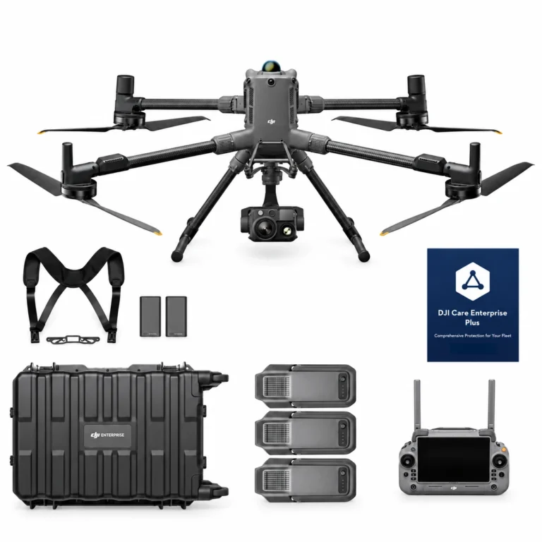
DJI Matrice 400 H30T Combo
AIQ-0102
48MP wide-angle camera, 40MP zoom camera with 34× hybrid optical zoom, 1280 × 1024 radiometric thermal imaging, NIR illumination and a laser range finder with up to 3,000 m measurement range, paired with the long-endurance DJI Matrice 400 enterprise platform. The Matrice 400 H30T Combo includes the Zenmuse H30T and three aircraft batteries, creating a powerful solution for asset inspection, energy and utilities, infrastructure, public safety and demanding day or night operations.
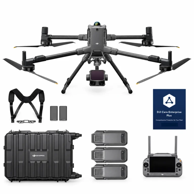
DJI Matrice 400 L3 Combo
AIQ-0100
1535 nm long-range LiDAR, dual 100MP RGB mapping cameras and a high-precision POS system, paired with the long-endurance DJI Matrice 400 enterprise platform for high-efficiency geospatial data capture. The Matrice 400 L3 Combo includes the Zenmuse L3 and three aircraft batteries, creating a complete solution for large-area surveying, corridor mapping, forestry and infrastructure projects.
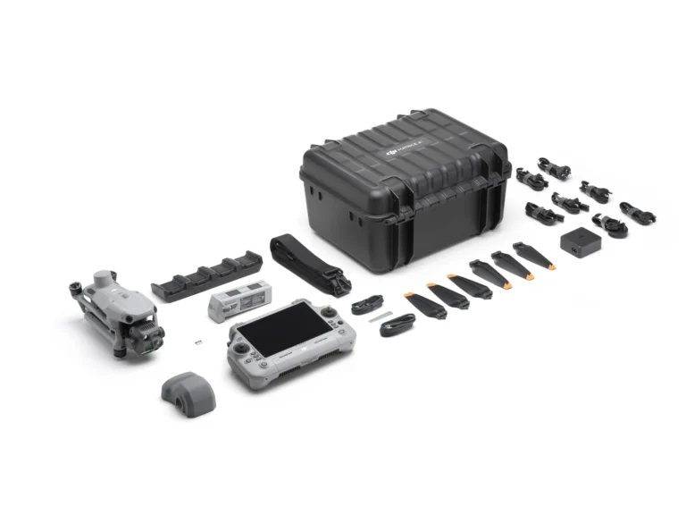
DJI Matrice 4T Essentials Combo
AIQ-0091
Compact enterprise drone for asset inspection, thermal imaging and situational awareness, combining wide-angle, medium telephoto, telephoto and radiometric thermal cameras with an integrated laser range finder. Long-range visual imaging, thermal data, low-light capability and intelligent flight tools support asset management, energy, utilities and infrastructure inspection workflows.
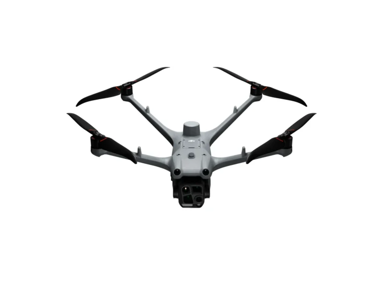
DJI Matrice 4TD Essentials Combo
AIQ-0097
48MP wide-angle, medium telephoto and telephoto cameras, combined with a radiometric thermal camera, NIR auxiliary light and laser range finder in a weather-resistant enterprise drone built for professional inspection and asset management. DJI Dock 3 compatibility, low-light imaging and long-range visual and thermal capture support repeatable energy, utilities, infrastructure and remote inspection workflows.
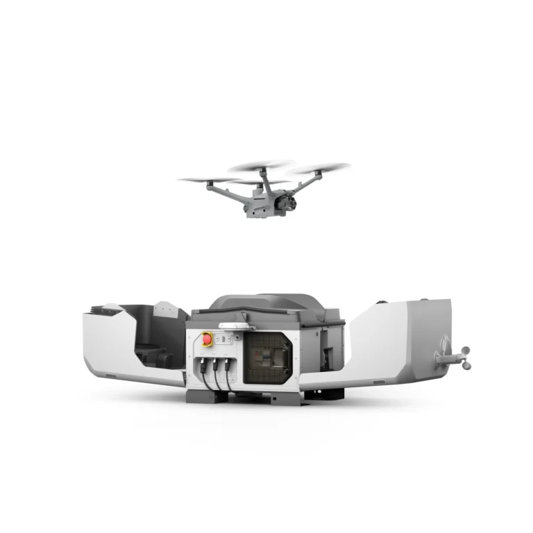
Dock Systems
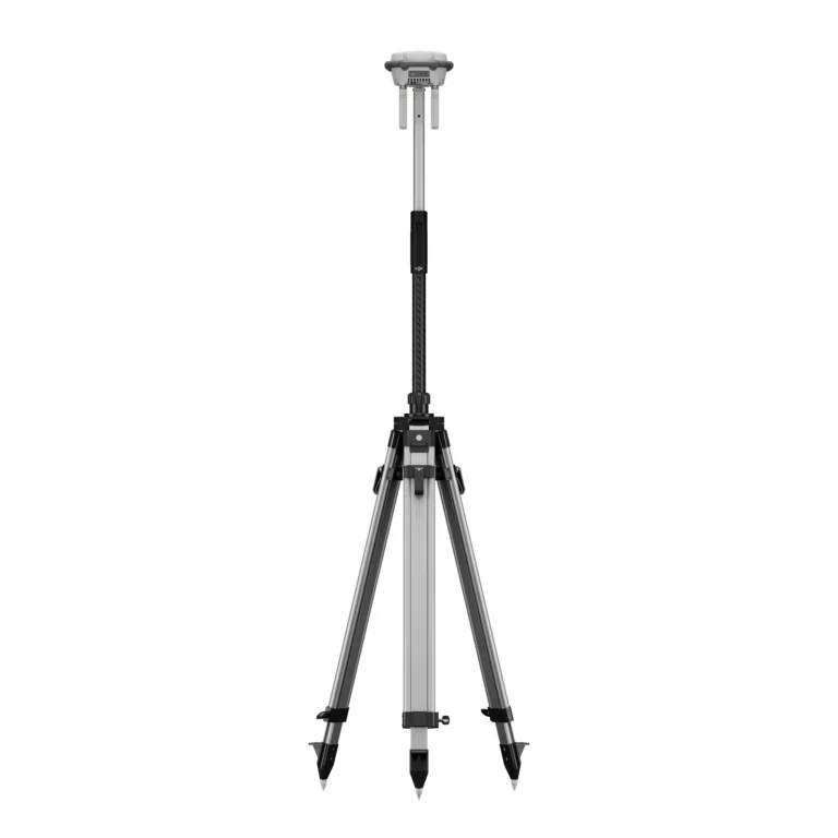
Accessories & Parts
Our services
How AeroIQ helps in this sector
Drone Consulting
Plan the right drone programme, workflows, governance and technology pathway from the start.
Drone Training
Build internal pilot capability through practical training, coaching and real-world operating scenarios.
Drone Hardware
Choose, configure and validate drone hardware, sensors and software so it works from day one.

Let’s talk