
INDUSTRY · Public Safety
Aerial Public Safety Intelligence for Faster, Safer and More Informed Operational Decisions
Decision-ready public-safety data: rapid, repeatable and mission-aligned, supporting search and rescue, emergency response, incident mapping, evidence capture and operational oversight.
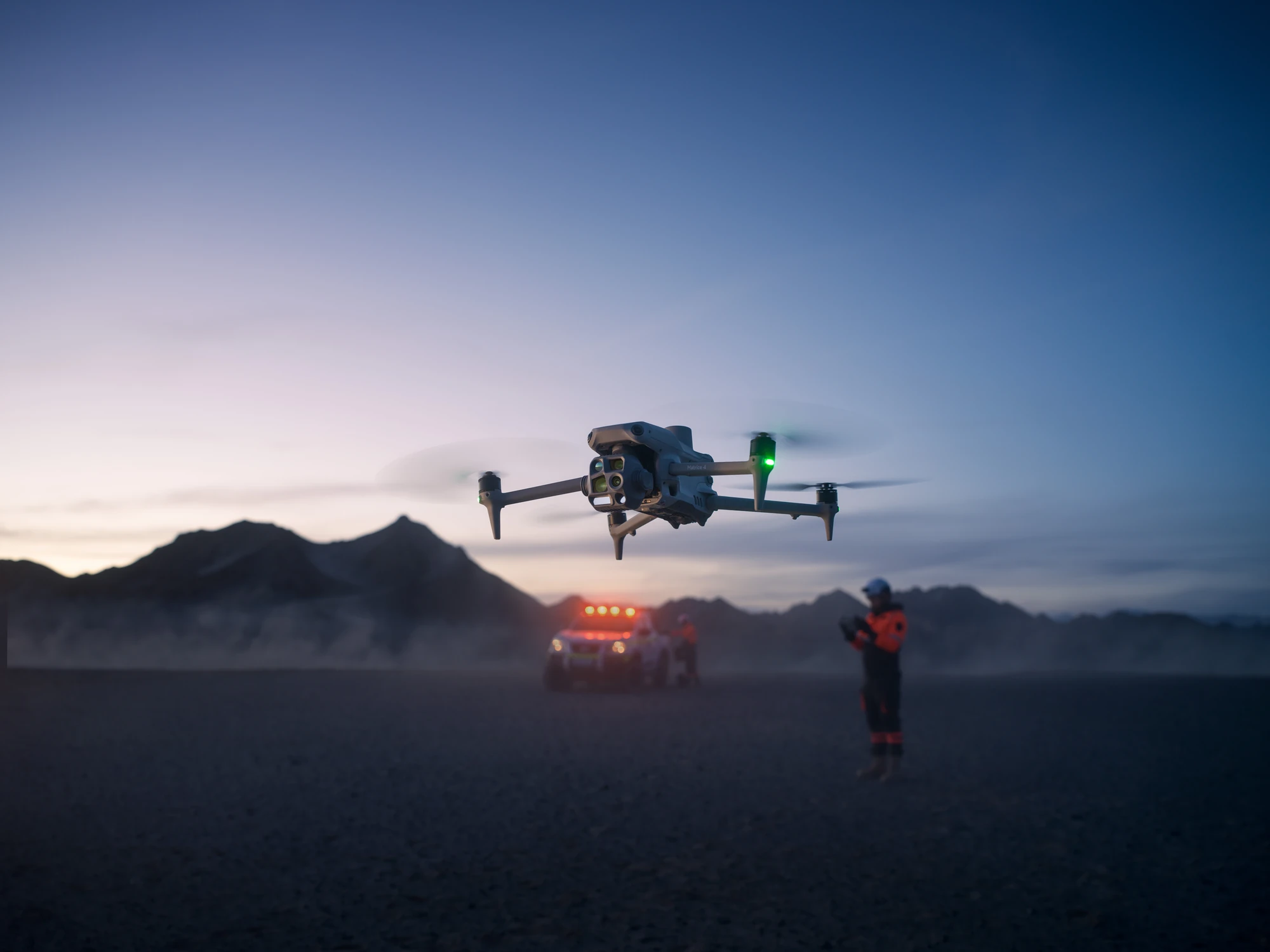
Why drones
Real-time visibility across complex incidents
- Wider situational awareness than ground-only response
- Thermal intelligence that reveals victims, hotspots, fire spread, structural heat and hidden hazards
- Safer operations: reduced exposure to hazards, fire, unstable structures and unknown terrain
- Repeatable aerial evidence for incident mapping, investigation and reporting
- High-resolution imagery, thermal layers and live video for rapid decision-making
- Faster identification of victims, hazards, fire spread, access routes and containment lines
- Targeted allocation of personnel, resources and specialist teams
- Stronger evidence for investigations, emergency management and inter-agency coordination
Drones don’t replace responders. They amplify them.
Key use cases
Where drones earn their place in Public Safety.
01
Disaster, storm & flood assessment
Drones rapidly map affected areas after storms, slips, floods or structural collapse. Aerial layers identify blocked access, damaged assets, unstable terrain and safe approach routes, supporting emergency management and recovery planning.
DAMAGE MAPS · FLOOD EXTENT · ACCESS ROUTES · CHANGE DETECTION
02
Search & rescue (SAR)
Thermal, RGB and night-vision sensors provide rapid aerial visibility across large or difficult terrain. Drones help locate missing persons, identify heat signatures and guide ground teams with real-time situational awareness, improving response speed and reducing risk.
THERMAL IMAGERY · RGB IMAGERY · LIVE VIDEO · SEARCH GRIDS
03
Fire, heat & hotspot intelligence
Thermal layers reveal hotspots, fire spread, containment lines and structural heat signatures. Aerial capture supports incident commanders with real-time intelligence, enabling safer deployment and more effective suppression strategies.
THERMAL LAYERS · HOTSPOT MAPS · LIVE VIDEO · SMOKE/HEAT ANALYSIS
04
Incident mapping & evidence capture
High-resolution orthomosaics and 3D models provide defensible evidence for investigations, crash reconstruction, crime-scene documentation and emergency-management reporting. Repeatable capture ensures consistent records across the incident lifecycle.
ORTHOMOSAICS · 3D MODELS · POINT CLOUDS · TIME-SERIES IMAGERY
05
Environmental, hazard & spill monitoring
Aerial capture supports hazardous-material response, environmental monitoring, spill assessment and containment planning. Drones provide rapid visibility without requiring responders to enter dangerous zones.
ORTHOMOSAICS · THERMAL LAYERS · VEGETATION INDICES · CHANGE DETECTION
06
Tactical & operational support
Live video and aerial overwatch improve situational awareness for tactical teams, crowd management, perimeter control and high-risk operations. Drones provide real-time intelligence without exposing personnel to unnecessary risk.
LIVE VIDEO · OVERWATCH IMAGERY · PERIMETER MAPS · TRACKING LAYERS
07
Inter-agency coordination & reporting
Consistent aerial layers support communication between Police, Fire, SAR, Civil Defence and emergency-management teams. Repeatable datasets improve operational planning, briefings and post-incident reporting.
ORTHOMOSAICS · 3D MODELS · SITUATION MAPS · TIME-SERIES REPORTS
Deliverables
Drone data outputs.
A suite of public-safety-ready deliverables that traditional ground-only methods cannot match for speed, resolution or completeness.
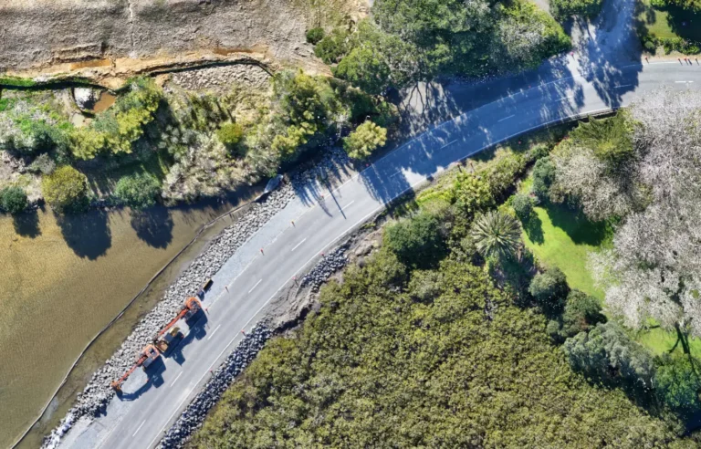
Orthomosaics
High-resolution, distortion-free georeferenced aerial maps
Used for
- Incident mapping
- evidence capture
- disaster assessment
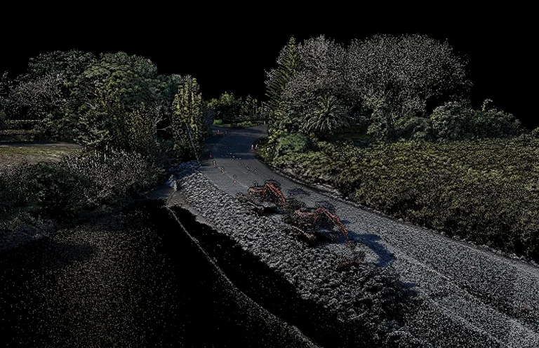
3D Point Clouds
Millions of georeferenced points representing terrain, structures and incident scenes
Used for
- Crash reconstruction
- crime-scene modelling
- structural assessment
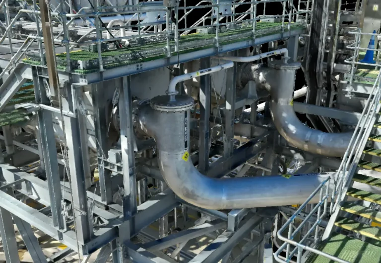
3D Meshes & Textured Models
Realistic visual models of structures, disaster zones and incident areas
Used for
- Investigation
- reporting
- tactical planning
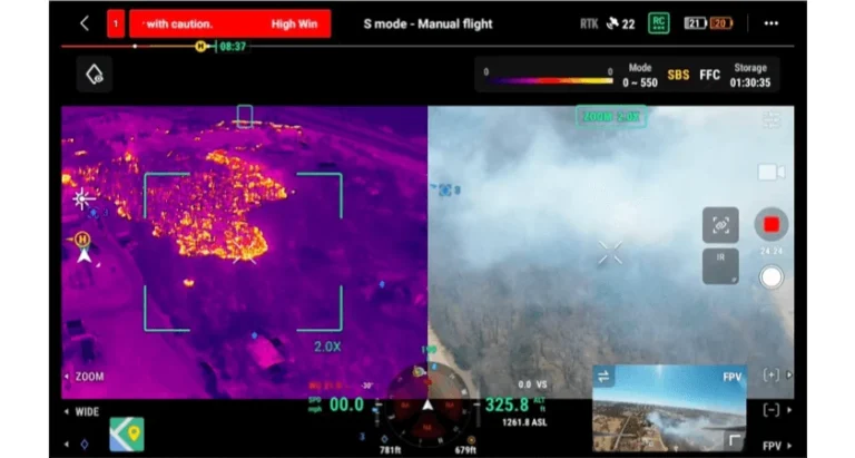
Radiometric Thermal Imagery
Radiometric temperature layers from thermal sensors
Used for
- Hotspot detection
- victim search
- fire spread
- night operations
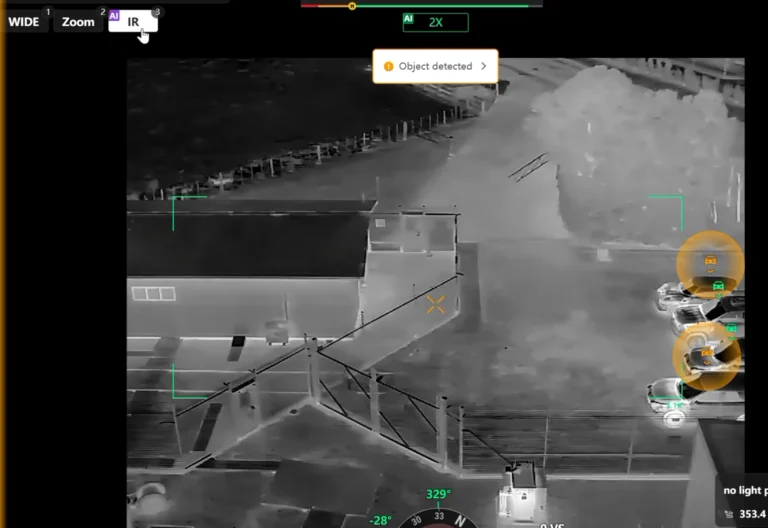
Live Video & Overwatch Feeds
Real-time aerial video streamed to command units
Used for
- Tactical support
- crowd management
- SAR coordination
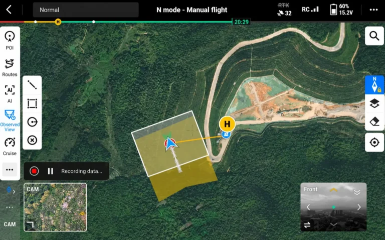
Search Grids & Tracking Layers
Structured spatial layers showing search coverage, tracks and areas of interest
Used for
- SAR operations
- tactical planning
- resource allocation
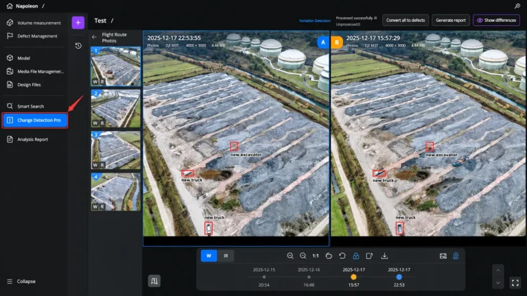
Change Detection Layers
Time-series comparisons showing incident progression or environmental change
Used for
- Disaster monitoring
- post-event verification
- operational reporting
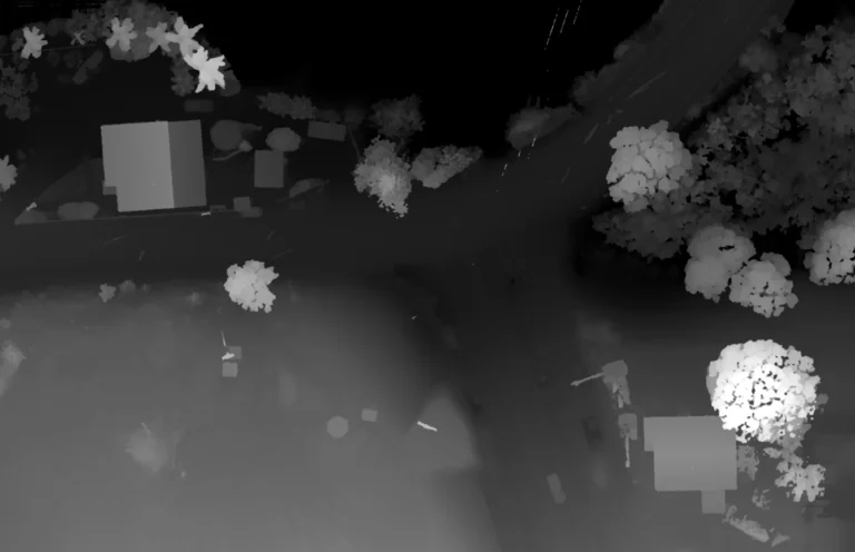
Digital Surface Models (DSM)
Elevation of visible surfaces, structures and terrain
Used for
- Damage assessment
- flood modelling
- hazard review
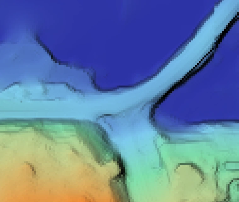
Digital Terrain Models (DTM)
Bare-earth elevation models with vegetation removed
Used for
- Access planning
- slip/flood analysis
- emergency routing
Products
Systems & equipment for Public Safety
Drones
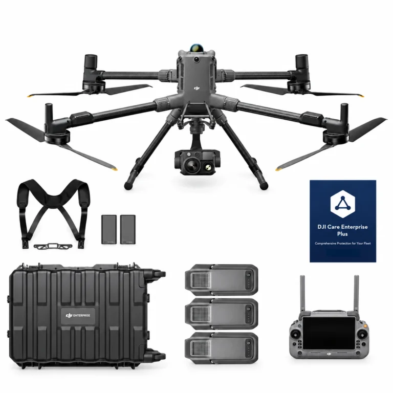
DJI Matrice 400 H30T Combo
AIQ-0102
48MP wide-angle camera, 40MP zoom camera with 34× hybrid optical zoom, 1280 × 1024 radiometric thermal imaging, NIR illumination and a laser range finder with up to 3,000 m measurement range, paired with the long-endurance DJI Matrice 400 enterprise platform. The Matrice 400 H30T Combo includes the Zenmuse H30T and three aircraft batteries, creating a powerful solution for asset inspection, energy and utilities, infrastructure, public safety and demanding day or night operations.
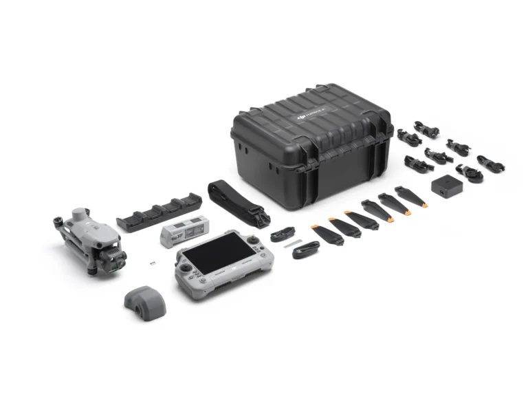
DJI Matrice 4T Essentials Combo
AIQ-0091
Compact enterprise drone for asset inspection, thermal imaging and situational awareness, combining wide-angle, medium telephoto, telephoto and radiometric thermal cameras with an integrated laser range finder. Long-range visual imaging, thermal data, low-light capability and intelligent flight tools support asset management, energy, utilities and infrastructure inspection workflows.
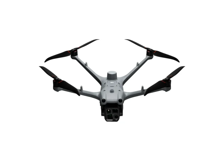
DJI Matrice 4TD Essentials Combo
AIQ-0097
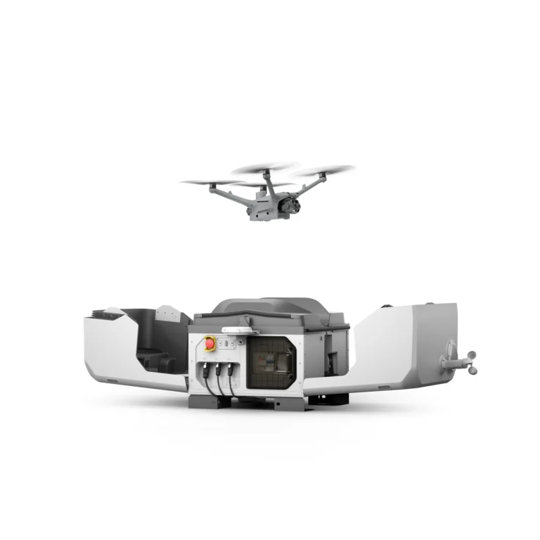
48MP wide-angle, medium telephoto and telephoto cameras, combined with a radiometric thermal camera, NIR auxiliary light and laser range finder in a weather-resistant enterprise drone built for professional inspection and asset management. DJI Dock 3 compatibility, low-light imaging and long-range visual and thermal capture support repeatable energy, utilities, infrastructure and remote inspection workflows.
Dock Systems
Accessories & Parts
Our services
How AeroIQ helps in this sector
Drone Consulting
Plan the right drone programme, workflows, governance and technology pathway from the start.
Drone Training
Build internal pilot capability through practical training, coaching and real-world operating scenarios.
Drone Hardware
Choose, configure and validate drone hardware, sensors and software so it works from day one.

Let’s talk