
Product
Zenmuse H30T
DJI · AIQ-0069
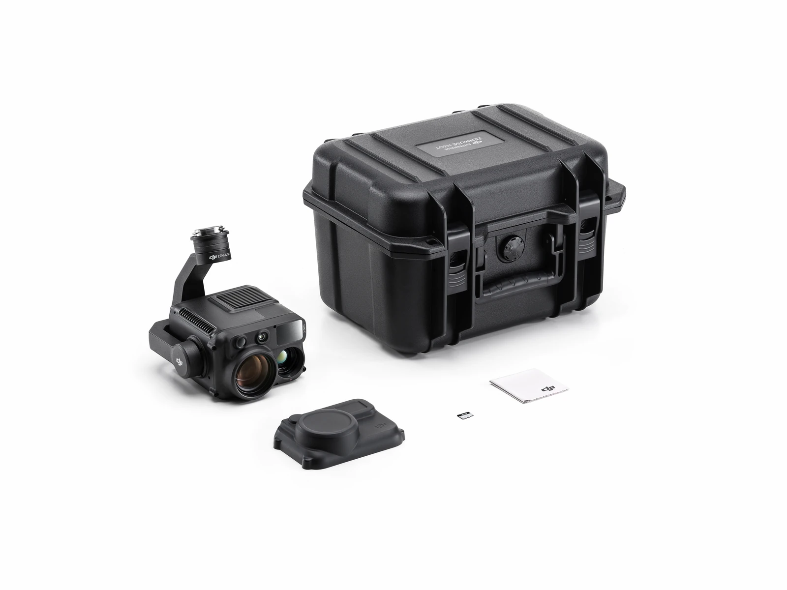
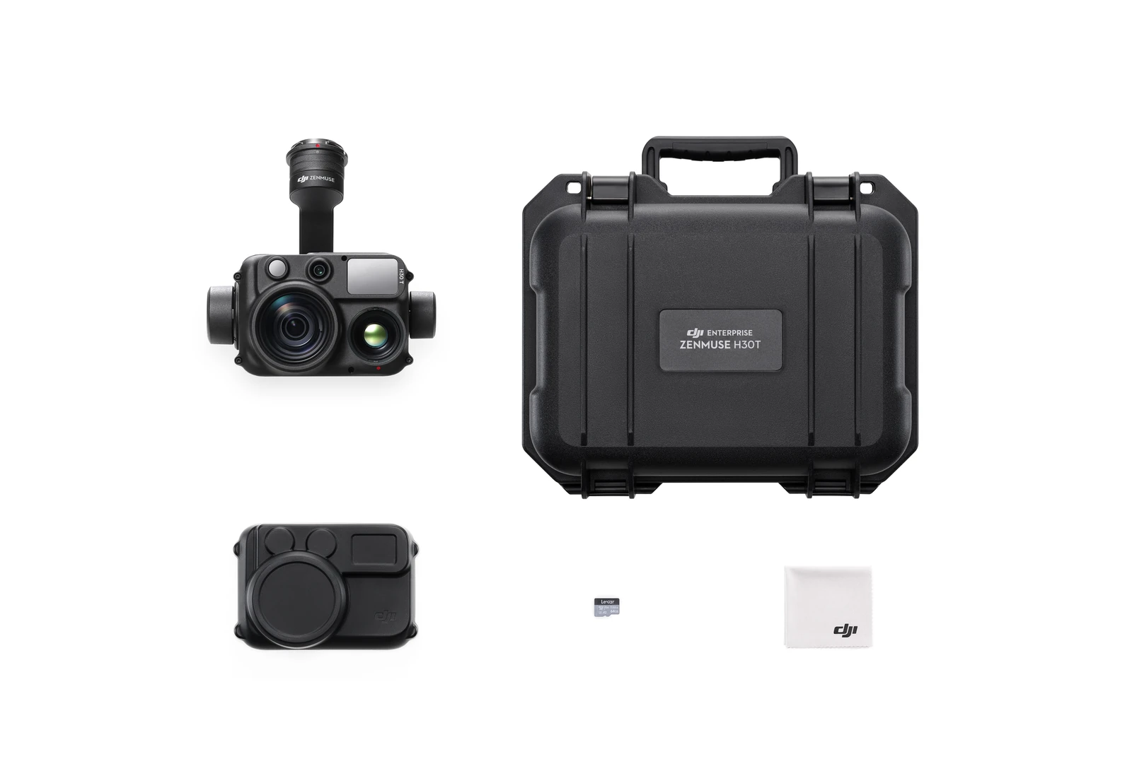
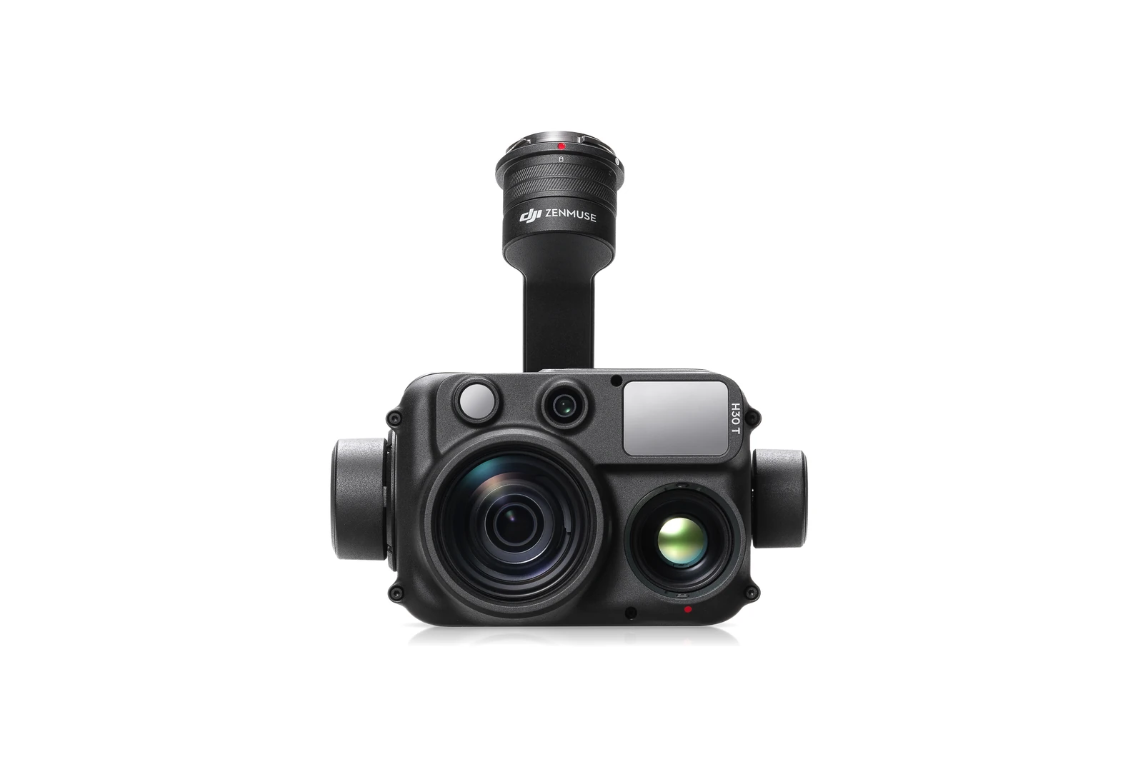
48MP wide-angle camera, 40MP high-resolution zoom camera with 34× hybrid optical zoom, native 1280 × 1024 radiometric thermal imaging, NIR illumination and laser ranging, integrated into a five-sensor enterprise inspection payload. The DJI Zenmuse H30T is designed for energy and utility inspection, infrastructure and asset management, industrial monitoring, public safety and other applications requiring detailed visual and thermal information from a safe stand-off distance.
- Thermal camera resolution1280 × 1024
- Zoom camera sensor1/1.8-inch CMOS, 40 MP
- Laser range finder3–3000 m
- Ingress protectionIP54
Overview
About this product.
The DJI Zenmuse H30T is a multi-sensor enterprise payload designed for detailed inspection, thermal imaging and situational awareness across demanding professional environments. It combines a 48MP wide-angle camera, 40MP zoom camera, native high-resolution infrared thermal camera, laser range finder and NIR auxiliary light within a single three-axis stabilised payload, allowing operators to move between broad visual context, detailed long-range inspection, temperature measurement and low-light observation without changing equipment.
Its zoom camera provides up to 34× hybrid optical zoom and 400× maximum zoom, supporting detailed inspection of assets from greater distances. At the same time, the H30T's 1280 × 1024 thermal sensor provides radiometric temperature information for identifying heat patterns and potential anomalies across electrical, mechanical, industrial and infrastructure assets.
For operations extending beyond daylight hours, Night Scene mode, electronic dehazing and an integrated 850 nm NIR auxiliary light improve visibility in challenging conditions. Combined with a laser range finder capable of measuring targets from 3 m to 3,000 m, the H30T provides a versatile aerial inspection system for applications where operators need to see, measure and assess assets from the air.
Long-Range Visual Inspection
- 40MP Zoom Camera: A 1/1.8-inch CMOS sensor captures detailed imagery for inspecting infrastructure, equipment and other assets from a greater stand-off distance.
- 34× Hybrid Optical Zoom: Extended optical reach allows operators to examine smaller details without positioning the aircraft as close to the asset being inspected.
- Up to 400× Maximum Zoom: Additional digital magnification provides greater flexibility when locating or observing distant subjects.
- 48MP Wide-Angle Camera: The 1/1.3-inch CMOS wide camera provides high-resolution imagery and a broader field of view for documenting overall asset and site conditions.
- Foreground Stabilisation: Image stabilisation helps maintain clearer imagery when inspecting distant subjects at higher zoom levels, improving usability for applications such as powerline inspection.
- Electronic Dehazing: Image processing can reduce the effects of atmospheric haze and moisture, improving visibility when inspecting distant assets in less-than-ideal conditions.
- Smart Capture: Camera parameters can be automatically adjusted around the scene and available lighting to improve image quality across changing inspection conditions.
- High-Res Grid Photo: Supported grid-photography functionality allows operators to capture higher-resolution detail across selected areas for closer review.
High-Resolution Thermal Imaging
- Native 1280 × 1024 Thermal Sensor: The H30T uses a native-resolution uncooled VOx microbolometer, providing significantly more thermal detail for inspection and monitoring applications.
- Radiometric Temperature Measurement: Spot, centre-point and area measurements allow operators to assess temperatures directly within captured thermal imagery.
- High Gain Mode: Provides a measurement range of -20°C to 150°C for applications requiring more precise measurement across lower temperature ranges.
- Low Gain Mode: Extends standard temperature measurement from 0°C to 600°C for hotter industrial and infrastructure applications.
- Up to 1,600°C with Infrared Density Filter: An optional Infrared Density Filter extends the supported measurement range to as high as 1,600°C for specialised high-temperature inspections.
- 32× Thermal Digital Zoom: Infrared imagery can be digitally magnified to help operators examine smaller or more distant thermal features.
- UHR Infrared Image: Ultra-High Resolution processing supports clearer infrared imagery when operating at 5× thermal zoom or greater.
- Temperature Alerts: Configurable thermal alerts help operators identify areas that exceed defined temperature thresholds during inspection.
Night and Low-Light Operations
- Night Scene Mode: Optimised low-light processing improves visible-light imagery after dark and supports selectable frame rates of 25 fps, 15 fps and 5 fps.
- High-Sensitivity Zoom Camera: In Night Scene mode, the zoom camera supports ISO values up to 819,200, improving visibility in very low-light conditions.
- 850 nm NIR Auxiliary Light: Integrated near-infrared illumination provides additional visibility where available light is insufficient.
- Approx. 8 m Illumination Area at 100 m: Under DJI's specified conditions, the NIR light produces an illuminated area approximately 8 metres in diameter at a distance of 100 metres.
- IR Light Mode: The zoom-camera feed can switch to a greyscale infrared-assisted view, increasing contrast between light and dark areas when locating subjects in low-light environments.
Laser Ranging and Target Positioning
- 3 m to 3,000 m Measurement Range: The integrated laser range finder provides distance information across both close and long-range inspection scenarios, with actual performance dependent on the target and environmental conditions.
- 905 nm Laser Range Finder: A Class 1 laser is integrated directly into the payload for remote measurement and target positioning.
- Long-Range Asset Measurement: Under DJI's specified conditions, typical range figures include approximately 2,000 m for grassland, 1,900 m for woodland and 1,700 m for road surfaces.
- PinPoint Positioning: Laser ranging can be combined with aircraft positioning information to establish the geographic location of observed subjects and assets during field operations. DJI specifies PinPoint accuracy of 20 m at a distance of 1 km after the required aircraft manoeuvre.
Intelligent Inspection Features
- Link Zoom: Visible-light and thermal views can work together to help operators maintain context while examining an area at higher magnification.
- Click to Aim: Quickly reposition the payload toward a selected point within the live view, reducing manual gimbal adjustment during inspection.
- Pre-Recording: The camera can cache footage before recording begins, allowing events immediately preceding the operator pressing record to be retained.
- DJI FlightHub 2 Compatibility: H30T can be incorporated into DJI FlightHub 2 workflows for remote operations, live viewing and enterprise mission management.
- General Mapping Support: DJI also supports general surveying and mapping with the H30 Series, although its primary strength remains inspection and situational-awareness applications rather than dedicated photogrammetry.
Thermal Analysis and Data Workflow
- DJI Thermal Analysis Tool 3: Radiometric R-JPEG files captured by the H30T can be analysed after the flight using DJI Thermal Analysis Tool 3 for detailed temperature review and reporting.
- DJI Terra: H30 Series imagery can be incorporated into DJI Terra workflows where mapping and reconstruction are required.
- DJI FlightHub 2: Supports cloud-based mission management, data review and remote operational workflows with compatible aircraft.
- R-JPEG Thermal Images: Thermal photographs retain radiometric information, allowing temperatures and thermal patterns to be reviewed after data collection rather than relying only on observations made during flight.
Built for Professional Field Operations
- IP54 Protection: The Zenmuse H30T is IP54 rated under controlled laboratory conditions, providing additional protection for professional outdoor operations.
- Three-Axis Stabilised Gimbal: Tilt, roll and pan stabilisation provides a stable imaging platform for detailed visual and thermal inspection.
- 920 g Payload Weight: The complete H30 Series payload weighs approximately 920 g, integrating five sensor modules within a single gimbal system.
- DJI SKYPORT Mount: A detachable DJI SKYPORT interface allows the payload to be installed across compatible DJI Enterprise aircraft.
Compatible DJI Aircraft
The DJI Zenmuse H30T is compatible with the DJI Matrice 400, Matrice 350 RTK and Matrice 300 RTK, with the Matrice 300 RTK requiring DJI RC Plus. On supported platforms, the H30T can be fitted to any compatible gimbal port, giving organisations flexibility when configuring the aircraft for different inspection and multi-payload workflows.
When paired with the DJI Matrice 400, the H30T creates a particularly capable platform for long-range asset inspection, thermal monitoring and complex enterprise operations. The Matrice 400 officially supports the H30T alongside other DJI payloads including the Zenmuse L3, L2 and P1.
Key capabilities
- Wide-Angle Camera: 1/1.3-inch CMOS, 48MP
- Zoom Camera: 1/1.8-inch CMOS, 40MP
- Visual Zoom: 34× hybrid optical zoom, up to 400× maximum zoom
- Infrared Thermal Camera: Native 1280 × 1024 uncooled VOx microbolometer
- Thermal Digital Zoom: Up to 32×
- Standard Temperature Measurement: -20°C to 150°C in High Gain / 0°C to 600°C in Low Gain
- Extended Temperature Measurement: Up to 1,600°C with optional Infrared Density Filter
- Laser Range Finder: 3 m to 3,000 m
- NIR Auxiliary Light: 850 nm, approximately 8 m illumination diameter at 100 m under stated conditions
- Gimbal: Three-axis stabilised
- Protection Rating: IP54
- Compatible Aircraft: DJI Matrice 400, Matrice 350 RTK and Matrice 300 RTK with DJI RC Plus
- Thermal Analysis: DJI Thermal Analysis Tool 3
- Enterprise Software: DJI FlightHub 2 and DJI Terra
Typical applications
Energy and utility inspection, powerline and substation inspection, solar farm inspection, wind turbine inspection, infrastructure and bridge inspection, industrial facilities, oil and gas, asset management, building inspection, geothermal inspection, wildlife monitoring, search and rescue, firefighting and other applications requiring detailed visual and radiometric thermal data. DJI lists energy inspection, facilities and infrastructure, public safety and wildlife applications among the primary use cases for the H30 Series. The DJI Zenmuse H30T is particularly suited to operations where teams need to inspect assets from a safe distance while collecting several types of information during the same flight. Combining high-resolution visual cameras, long-range zoom, native radiometric thermal imaging, NIR illumination and laser ranging within one payload reduces the need to switch sensors and provides inspection teams with a more complete view of asset condition across day, night and challenging operating environments.
Technical data
Specifications.
| Thermal | |
|---|---|
| Thermal camera resolution | 1280 × 1024 |
| Thermal measurement (high gain) | -20 to 150 °C |
| Thermal measurement (low gain) | 0 to 600 °C |
| Thermal measurement (with Infrared Density Filter) | to 1600 °C |
| Cameras | |
| Zoom camera sensor | 1/1.8-inch CMOS, 40 MP |
| Zoom lens (equivalent) | 33.4–809.3 mm |
| Laser range finder | 3–3000 m |
| NIR auxiliary light | 850 nm |
| General | |
| Weight | 920±5 g |
| Ingress protection | IP54 |
| Operating temperature | -20 to 50 °C |

Talk to AeroIQ