
Product
Zenmuse L3
DJI · AIQ-0053
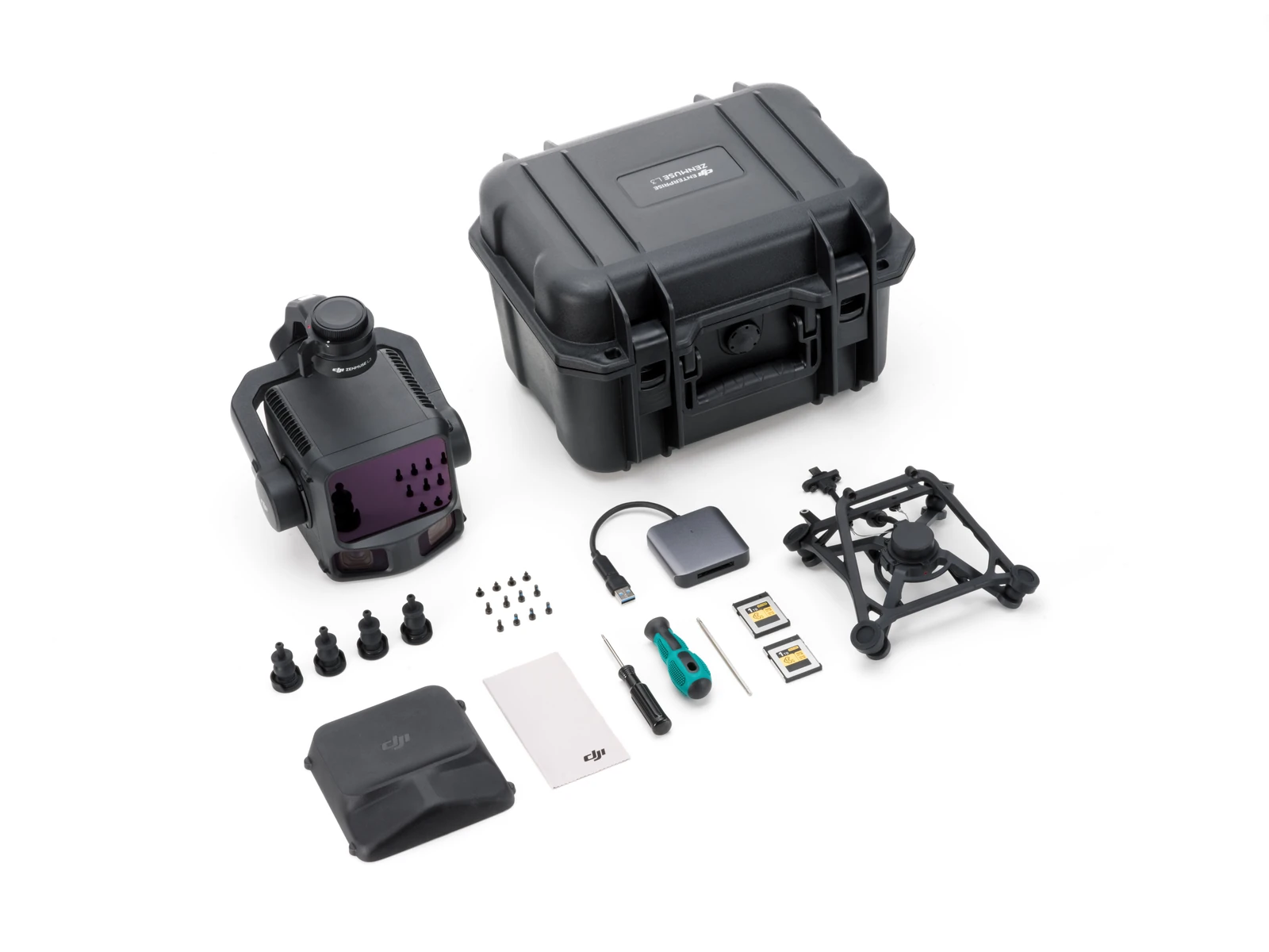
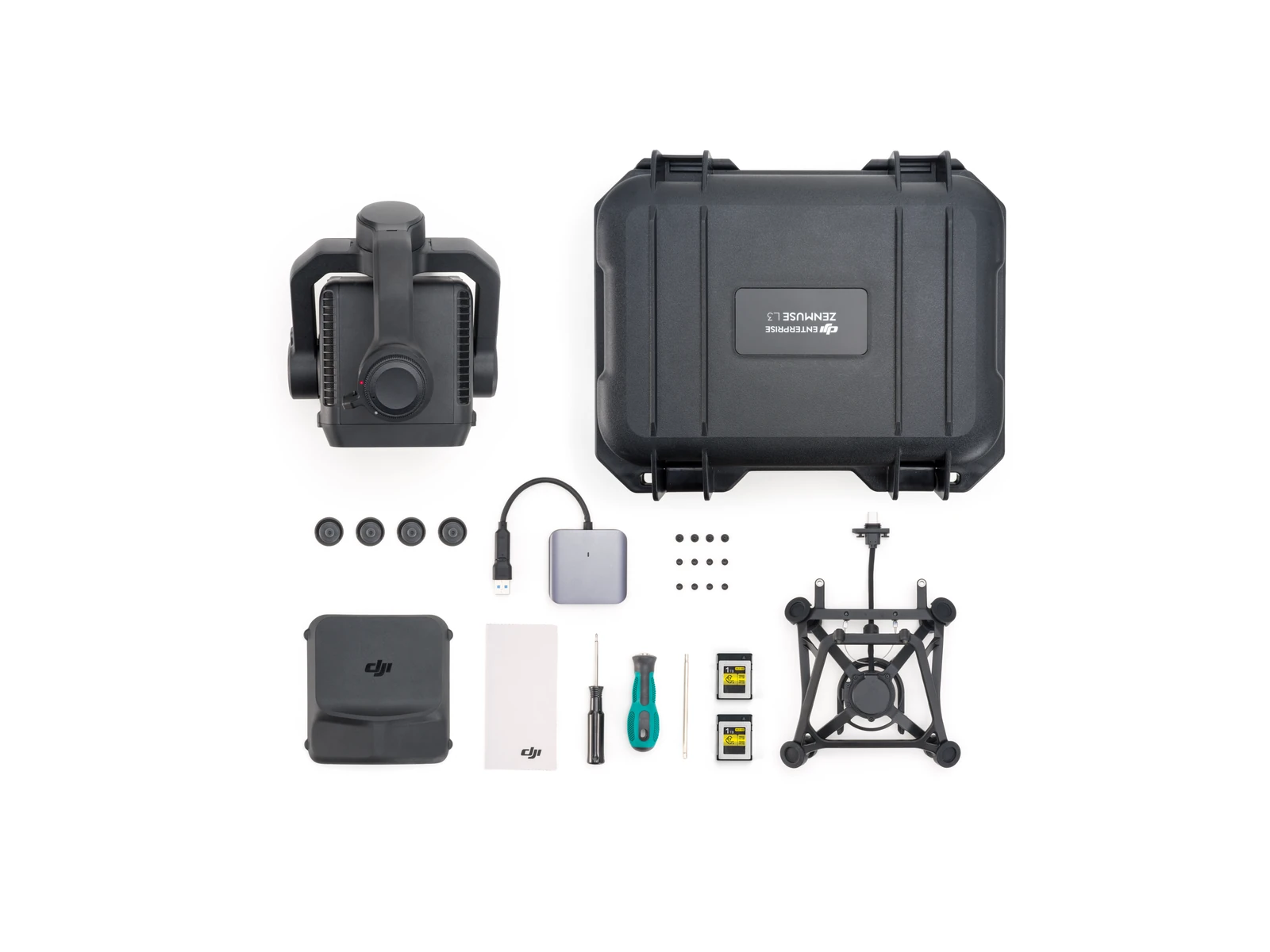
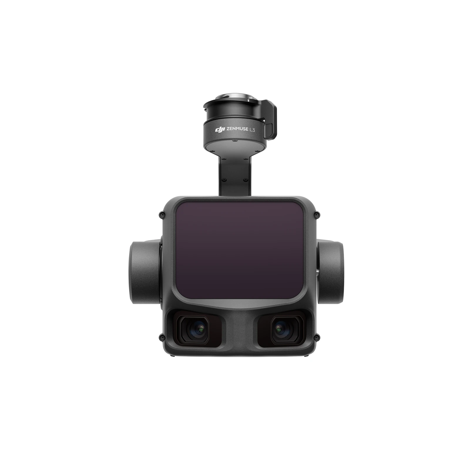
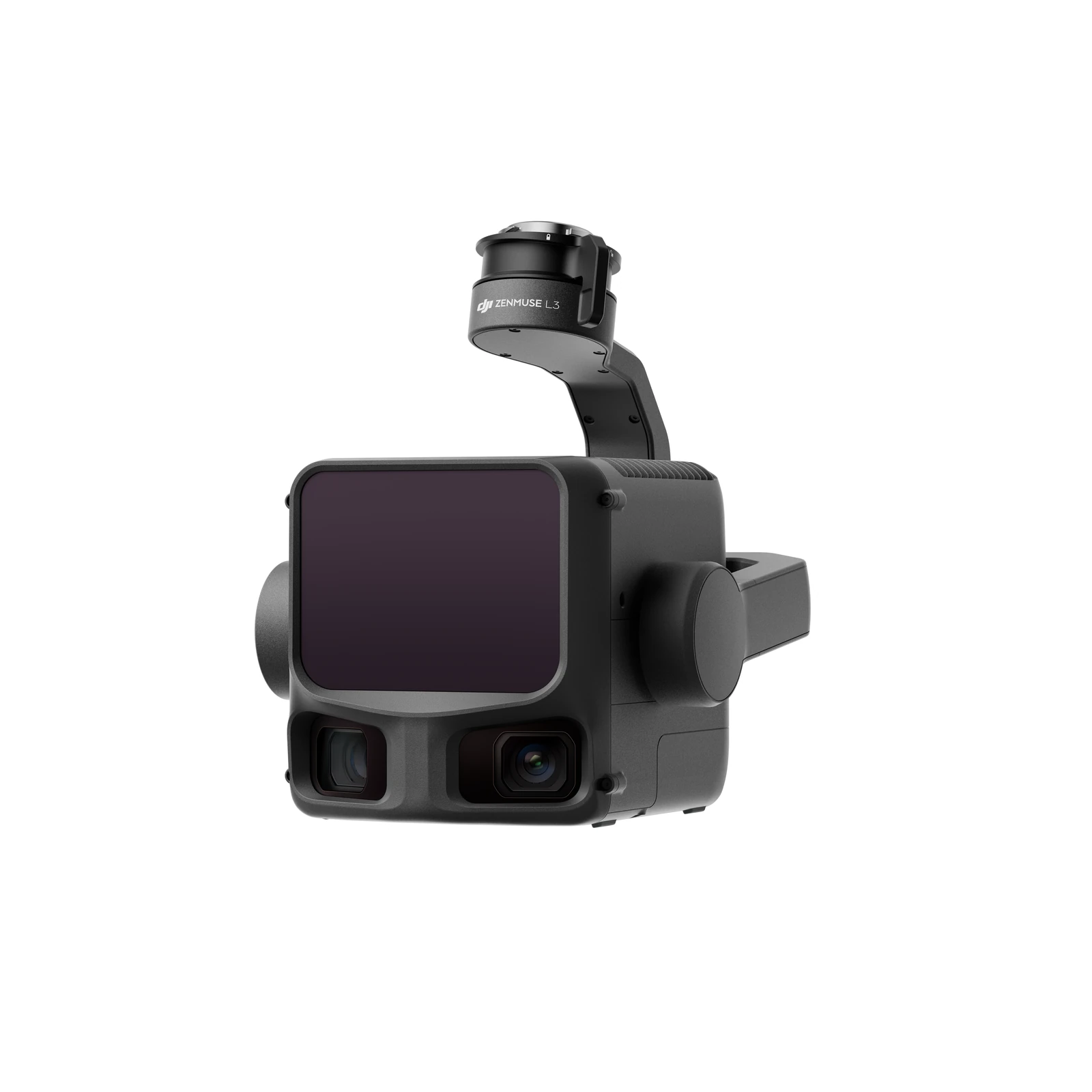
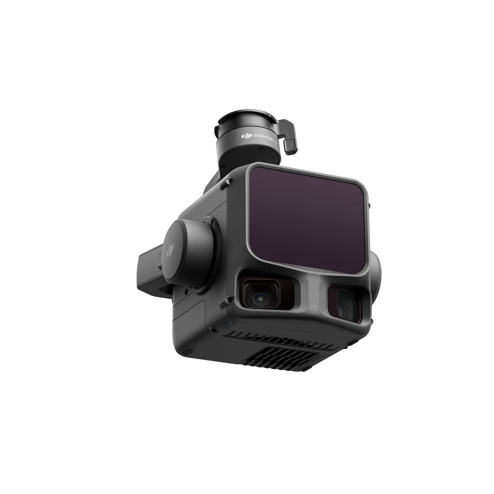
1535 nm long-range LiDAR, dual 100MP 4/3 CMOS RGB mapping cameras and a high-precision POS system, integrated into a professional aerial LiDAR payload for the DJI Matrice 400. The DJI Zenmuse L3 is designed for high-accuracy surveying, topographic mapping, corridor mapping, forestry and infrastructure projects, combining long-range LiDAR capture with high-resolution RGB imagery in a single workflow.
- LiDAR wavelength1535 nm
- Detection range2000 m
- Ranging accuracy±10 mm
- RGB mapping camerasDual, 100 MP each
- Ingress protectionIP54
Overview
About this product.
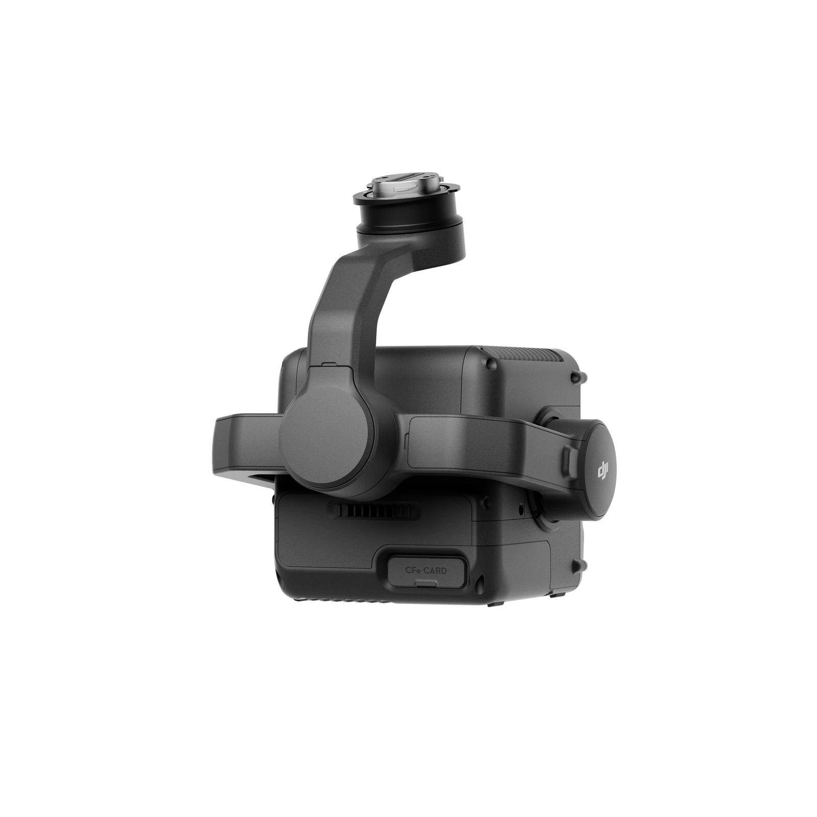
The DJI Zenmuse L3 is a long-range, high-accuracy aerial LiDAR system developed for professional geospatial data capture with the DJI Matrice 400. It combines a 1535 nm LiDAR sensor, dual 100MP RGB mapping cameras, high-precision position and orientation system and three-axis gimbal within a single integrated payload, allowing detailed point clouds and high-resolution imagery to be collected during the same mission.
Designed for larger and more demanding survey projects, the L3 can detect 10% reflectivity targets at distances of up to 950 metres under DJI's specified conditions. Its extended operating range allows data to be collected from higher altitudes while maintaining the detail required for professional mapping, helping increase coverage across large sites, long corridors and difficult terrain.
The Zenmuse L3 also brings LiDAR, photogrammetry and positioning into a connected DJI geospatial workflow. Data is collected through DJI Pilot 2 and processed in DJI Terra, with additional support for DJI Modify and DJI FlightHub 2. The result is a streamlined workflow from flight planning and aerial capture through to point clouds, elevation models, orthomosaics and other geospatial deliverables.
Long-Range LiDAR Surveying
- 1535 nm Long-Range LiDAR: The L3 uses a 1535 nm laser system designed for long-range aerial surveying, supporting data capture from higher operating altitudes and across larger areas.
- Up to 950 m Detection Range: Detects targets with 10% reflectivity at up to 950 m at 100 kHz under DJI's specified test conditions, extending the practical range available for aerial LiDAR capture.
- High Pulse Rate: Supports pulse frequencies from 100 kHz through to 2,000 kHz, allowing operators to balance operating altitude, point density and project requirements.
- Up to 16 Returns: Supports as many as 16 returns at 100 kHz and 350 kHz, helping capture information from multiple surfaces along the same laser path.
- Multiple Scanning Modes: Linear, Star-Shaped and Non-Repetitive scanning modes provide different collection patterns for topographic, forestry, infrastructure and corridor surveying.
- High Ranging Precision: DJI specifies absolute ranging accuracy of ±10 mm and repeatability below 5 mm under its stated test conditions.
High-Accuracy Point Cloud Capture
- 3 cm Vertical Accuracy at 120 m: Under DJI's specified workflow and test conditions, the L3 achieves point-cloud system accuracy of 3 cm vertical and 4 cm horizontal RMSE at a 120 m flight altitude.
- 5 cm Vertical Accuracy at 300 m: At 300 m, DJI specifies 5 cm vertical and 7.5 cm horizontal RMSE, supporting accurate survey outputs while operating at greater heights.
- Thin, Detailed Point Clouds: Point-cloud thickness is specified at 1.2 cm at 120 m and 2 cm at 300 m under DJI's stated conditions, supporting detailed surface definition and reconstruction.
- Improved Ground Penetration: A smaller laser spot and higher single-pulse energy allow more ground points to be collected through vegetation, improving terrain reconstruction in forestry and densely vegetated environments.
- Powerline Detection: The L3's range, spot size and wide scanning field support detailed capture of power infrastructure and DJI's Power Line Follow workflow when paired with the Matrice 400.
Dual 100MP RGB Mapping Cameras
- Dual 4/3 CMOS Sensors: Two 100MP RGB mapping cameras capture high-resolution colour imagery alongside LiDAR data, allowing visual mapping information and point clouds to be collected within the same flight.
- 107° Combined Horizontal FOV: The dual-camera configuration provides a wide combined horizontal field of view, increasing the area captured with each pass.
- 3 cm GSD at 300 m: DJI specifies an average RGB ground sampling distance of approximately 3 cm at a 300 m nadir flight altitude.
- Mechanical Shutters: Both mapping cameras use mechanical shutters to support accurate aerial image capture during professional photogrammetry missions.
- 100MP or 25MP Capture: Operators can select between 100MP and 25MP image resolutions depending on project requirements and data volume.
- LiDAR and Photogrammetry in One Mission: The wide dual-camera arrangement allows digital orthophoto and elevation data to be collected alongside LiDAR with relatively low side overlap, improving field efficiency.
High-Precision POS and PPK Support
- Integrated Position and Orientation System: The L3 combines GNSS and high-rate orientation measurements to accurately record the position and attitude of the payload throughout the flight.
- RTK Positioning Accuracy: DJI specifies positioning accuracy of 1.0 cm + 1 ppm horizontally and 1.5 cm + 1 ppm vertically with an RTK fix.
- High-Precision Attitude Data: Post-processed attitude accuracy is specified at 0.02° for yaw and 0.01° for pitch and roll.
- PPK Workflow Support: The L3 supports DAT, RINEX, RTCM and OEM differential data formats, allowing projects to use post-processed positioning where required.
- D-RTK 3 Integration: The D-RTK 3 Multifunctional Station can provide differential data for high-accuracy RTK and PPK surveying workflows with the Matrice 400 and Zenmuse L3.
High-Efficiency Data Collection
- Large-Area Surveying: When paired with the Matrice 400, DJI states that the L3 can cover up to 10 km² in a single flight at 300 m under its specified operating conditions.
- Up to 100 km² per Day: Under DJI's stated test scenario, the system can achieve daily mapping coverage of up to 100 km², making it suited to very large survey projects and long corridor operations.
- Terrain Follow: Compatible flight modes support terrain-following operations, helping maintain more consistent collection geometry across changing ground elevation.
- Power Line Follow: Automated Power Line Follow supports transmission and distribution corridor data capture, with the L3's extended detection range and wider FOV allowing higher operating altitudes than the previous generation.
- Real-Time Point Cloud Preview: Operators can preview LiDAR point clouds in DJI Pilot 2 during field operations to help confirm data capture before leaving site. High-accuracy deliverables should then be generated through offline processing in DJI Terra.
Integrated DJI Geospatial Workflow
- DJI Pilot 2: Plan missions, configure LiDAR capture and review point-cloud information during field operations.
- DJI Terra: Process LiDAR and imagery into high-accuracy point clouds, elevation models, orthomosaics and 3D mapping outputs.
- DJI Modify: Work with processed point clouds and 3D data for cleaning, editing and downstream project workflows.
- DJI FlightHub 2: Real-time point-cloud results can be uploaded to FlightHub 2 for remote viewing and project collaboration where required.
- Standard Point Cloud Formats: DJI Terra can export point clouds in formats including LAS, LAZ, PLY, PCD, PNTS and S3MB for use in wider surveying, GIS and engineering workflows.
Matrice 400 Compatibility
The DJI Zenmuse L3 is designed for the DJI Matrice 400 and requires the dedicated Zenmuse L3 single-gimbal connector mounted to the aircraft's E1 port. This pairing provides the flight performance, payload integration and intelligent mission capabilities required to take advantage of the L3's long-range LiDAR, dual mapping cameras and automated surveying functions.
Key capabilities
- LiDAR: 1535 nm long-range LiDAR
- Detection Range: Up to 950 m on 10% reflectivity targets under DJI's stated conditions
- Maximum Pulse Frequency: Up to 2,000 kHz
- LiDAR Returns: Up to 16 returns at supported pulse frequencies
- Scanning Modes: Linear, Star-Shaped and Non-Repetitive
- RGB Mapping Cameras: Dual 100MP 4/3 CMOS
- Combined RGB Horizontal FOV: 107°
- Point Cloud Accuracy at 120 m: 3 cm vertical / 4 cm horizontal RMSE
- Point Cloud Accuracy at 300 m: 5 cm vertical / 7.5 cm horizontal RMSE
- RTK Positioning Accuracy: 1.0 cm + 1 ppm horizontal / 1.5 cm + 1 ppm vertical
- Protection Rating: IP54
- Compatible Aircraft: DJI Matrice 400 with Zenmuse L3 single-gimbal connector
- Data Collection: DJI Pilot 2
- Data Processing: DJI Terra
Typical applications
Topographic surveying, LiDAR mapping, corridor mapping, powerline surveying, forestry and vegetation mapping, construction and earthworks, mining, infrastructure mapping, land development, cadastral surveying, digital elevation modelling and other high-accuracy geospatial applications. The DJI Zenmuse L3 is particularly suited to projects where larger areas, difficult terrain or dense vegetation make conventional aerial mapping more challenging. Its combination of long-range LiDAR, multiple returns, strong penetration capability and dual 100MP RGB mapping cameras allows survey teams to collect detailed terrain information and high-resolution imagery efficiently, while integration with the Matrice 400, D-RTK 3 and DJI Terra provides a connected workflow from field capture through to professional geospatial deliverables.
Technical data
Specifications.
| LiDAR | |
|---|---|
| LiDAR wavelength | 1535 nm |
| Detection range (80% reflectivity, 100 kHz) | 2000 m |
| Detection range (10% reflectivity, 100 kHz) | 950 m |
| Detection range (10% reflectivity, 350 kHz) | 700 m |
| Ranging accuracy (absolute) | ±10 mm |
| Ranging repeatability (1σ) | < 5 mm |
| RGB mapping camera | |
| RGB camera sensor | 4/3 CMOS |
| RGB mapping cameras | Dual, 100 MP each |
| RGB image resolution | 12288×8192 |
| General | |
| Weight (without gimbal connector) | 1.60 kg |
| Ingress protection | IP54 |
| Operating temperature | -20 to 50 °C |

Talk to AeroIQ