

Product
Zenmuse P1
DJI · AIQ-0054
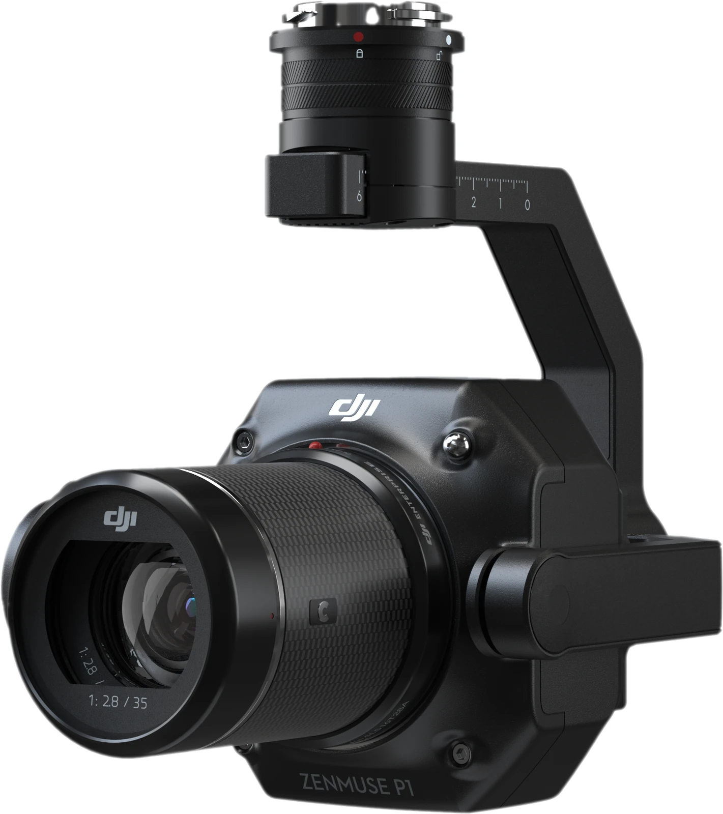
45MP full-frame sensor, global mechanical shutter, interchangeable 24 mm, 35 mm and 50 mm DJI DL lenses and a 0.7-second minimum photo interval, integrated into a professional aerial photogrammetry payload for high-accuracy mapping. The DJI Zenmuse P1 is designed for surveying, construction, land development, mining and large-scale 2D and 3D mapping, with compatibility across the DJI Matrice 400, Matrice 350 RTK and Matrice 300 RTK platforms.
- Sensor35.9 × 24 mm full frame
- Effective pixels45 MP
- Stabilisation3-axis, ±0.01°
- WeightApprox. 800 g
Overview
About this product.
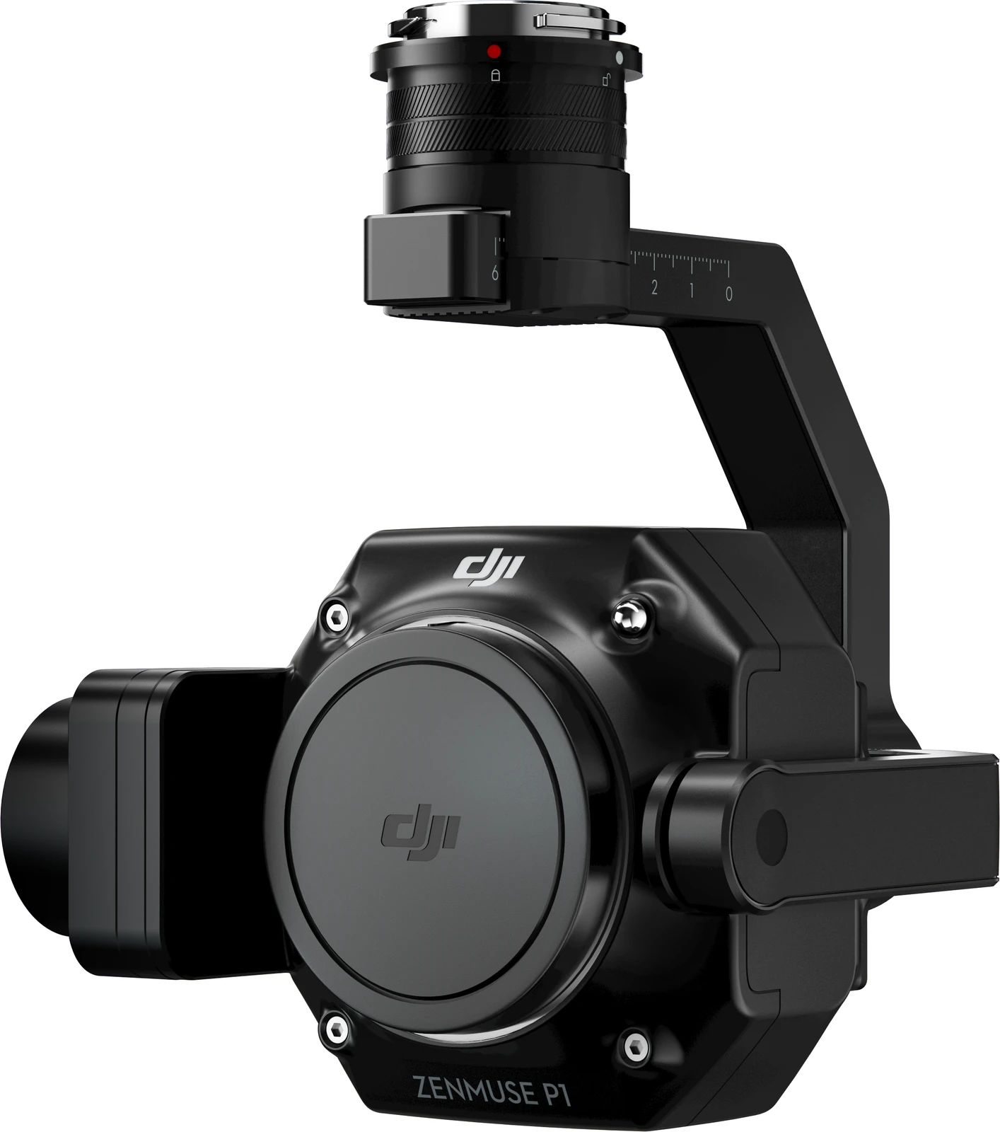
The DJI Zenmuse P1 is a professional aerial photogrammetry camera built around a 45MP full-frame sensor and three-axis stabilised gimbal. Designed specifically for surveying and mapping, it combines high-resolution imagery, a global mechanical shutter and interchangeable fixed-focus lenses to capture the detailed, geometrically consistent photographs required for accurate orthomosaics, point clouds and 3D models.
With a minimum image interval of 0.7 seconds and support for 24 mm, 35 mm and 50 mm DJI DL lenses, the P1 can be configured around different flight heights, ground sampling distances and project requirements. DJI specifies absolute mapping accuracy of 3 cm horizontally and 5 cm vertically under its stated test conditions, making the P1 well suited to professional geospatial applications where accuracy and repeatability are important.
When paired with the DJI Matrice 400, the P1 provides an integrated enterprise mapping solution for large-area surveying and detailed 3D reconstruction. Data can be collected using DJI Pilot 2 and processed through DJI Terra to generate deliverables including orthomosaics, digital surface models, point clouds and textured 3D models.
Full-Frame Photogrammetry Camera
- 45MP Full-Frame Sensor: A 35.9 × 24 mm sensor captures high-resolution aerial imagery with the detail required for professional photogrammetry, surveying and 3D reconstruction.
- 4.4 μm Pixel Size: The full-frame sensor uses 4.4 μm pixels to support detailed image capture across a wide range of mapping conditions.
- Global Mechanical Shutter: A mechanical shutter with speeds up to 1/2000 second helps minimise motion-related image distortion during mapping flights.
- 0.7-Second Photo Interval: Images can be captured as frequently as every 0.7 seconds, allowing efficient data collection across large survey areas.
- Three-Axis Stabilised Gimbal: The integrated gimbal stabilises the camera across tilt, roll and pan to maintain consistent image geometry throughout mapping missions.
- High-Sensitivity Imaging: DJI's low-noise, high-sensitivity imaging mode extends the range of lighting conditions in which the P1 can be used effectively.
Interchangeable DJI DL Lenses
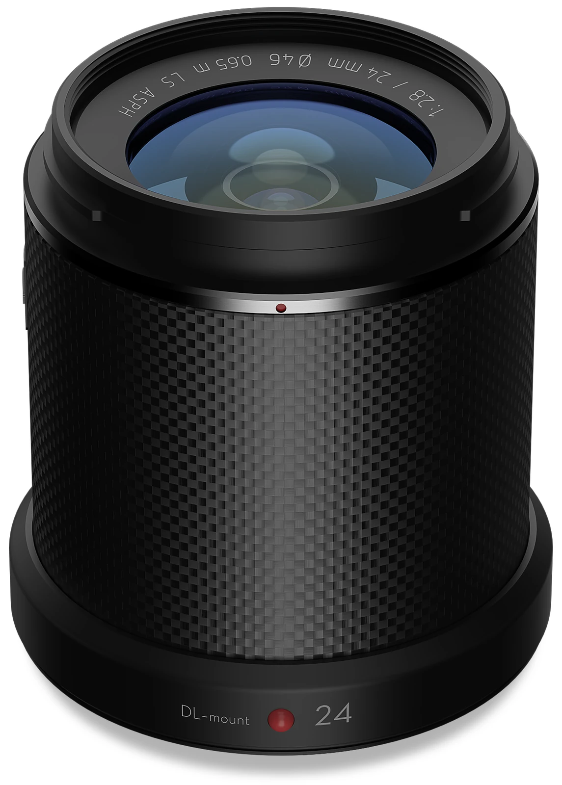
- 24 mm Lens: Provides an 84° field of view for broad area coverage and efficient mapping from lower operating heights.
- 35 mm Lens: Provides a 63.5° field of view and offers a versatile balance between coverage, operating altitude and image detail.
- 50 mm Lens: Provides a narrower 46.8° field of view for projects requiring increased stand-off distance or higher detail at greater operating heights.
- Fixed-Focus DL Mount: All three supported lenses use DJI's DL mount, allowing the payload configuration to be matched to the required GSD, site conditions and mapping workflow.
High-Accuracy Surveying and Mapping
- Centimetre-Level Mapping Accuracy: DJI specifies absolute accuracy of 3 cm horizontally and 5 cm vertically under its stated mapping conditions.
- TimeSync 2.0: Synchronises the camera, flight controller, RTK module and gimbal at the microsecond level to improve the accuracy of image positioning and orientation data.
- Position and Orientation Compensation: Precise camera exit-pupil position information is written into each image using aircraft and gimbal position and orientation data, supporting more accurate photogrammetric processing.
- RTK-Enabled Mapping: When used with a compatible RTK aircraft platform, the P1 supports high-accuracy georeferenced image capture and can significantly reduce reliance on ground control points for suitable projects.
- 2D and 3D Mapping: The P1 supports workflows for orthomosaics, oblique photography, detailed 3D reconstruction and other professional surveying applications.
Smart Oblique Capture and 3D Modelling
- Smart Oblique Capture: The three-axis gimbal automatically rotates the camera to capture the different viewing angles required for 3D reconstruction, reducing the need for multiple separate flight paths.
- Five-Direction Capture: The P1's Smart Oblique workflow captures imagery from multiple directions to provide the overlapping perspectives required for detailed three-dimensional reconstruction.
- Optimised Image Collection: Only images required for reconstruction are captured around the edges of the survey area, reducing unnecessary photographs and helping improve processing efficiency.
- Detailed 3D Models: High-resolution full-frame imagery makes the P1 suitable for generating detailed models of buildings, structures, terrain and infrastructure for surveying, engineering and asset-management workflows.
High-Efficiency Data Collection
- Large-Area Coverage: DJI states that the P1 can cover up to 3 km² in a single flight at a 5 cm GSD under its specified conditions when paired with a suitable aircraft platform.
- Rapid Image Capture: The combination of a 0.7-second minimum shooting interval and mechanical shutter supports efficient mapping at practical survey flight speeds.
- Flexible GSD Planning: The choice of 24 mm, 35 mm and 50 mm lenses allows operators to select an appropriate operating height and ground sampling distance for different survey requirements.
- Smart Data Management: Photos, GNSS information and TimeStamps.MRK files are organised within the mission data structure, simplifying transfer and downstream processing.
- Rich Image Metadata: Captured files include camera parameters and RTK status, helping photogrammetry software correctly interpret positioning and camera information during processing.
Integrated DJI Geospatial Workflow
- DJI Pilot 2: Plan and execute professional mapping missions using compatible DJI enterprise aircraft.
- DJI Terra: Process P1 imagery into orthomosaics, digital surface models, point clouds and detailed 3D reconstructions.
- DJI Modify: Photogrammetry models generated from P1 imagery can be refined and edited for applications requiring cleaner or more presentation-ready 3D outputs.
- Third-Party Workflows: Outputs from DJI Terra can be transferred into GIS, CAD, surveying and engineering software for further measurement, analysis and project delivery.
Compatible DJI Aircraft
The DJI Zenmuse P1 is compatible with the DJI Matrice 400, Matrice 350 RTK and Matrice 300 RTK. On the Matrice 400, the P1 can be fitted to the single downward gimbal connector or to either position on the dual downward gimbal connector. DJI notes that mapping accuracy may be reduced when another payload is simultaneously fitted to the dual-gimbal configuration, so a dedicated P1 configuration is preferable for applications where maximum mapping accuracy is required.
The Matrice 400 and Zenmuse P1 combination is DJI's current full-frame photogrammetry solution for professional land surveying, cadastral mapping and large-scale 3D reconstruction, integrating RTK positioning, intelligent mission planning and DJI Terra processing within the wider DJI Enterprise ecosystem.
Key capabilities
- Camera: 45MP full-frame sensor
- Sensor Size: 35.9 × 24 mm
- Pixel Size: 4.4 μm
- Photo Resolution: 8192 × 5460
- Shutter: Global mechanical shutter, up to 1/2000 s
- Minimum Photo Interval: 0.7 seconds
- Supported Lenses: DJI DL 24 mm, 35 mm and 50 mm fixed-focus lenses
- Absolute Mapping Accuracy: 3 cm horizontal / 5 cm vertical under DJI's stated conditions
- Gimbal: Three-axis stabilised
- Photogrammetry Functions: Mapping, oblique capture, Smart Oblique Capture and detailed 3D reconstruction
- Protection Rating: IP4X
- Compatible Aircraft: DJI Matrice 400, Matrice 350 RTK and Matrice 300 RTK
- Data Processing: DJI Terra
Typical applications
Topographic surveying, cadastral surveying, construction and earthworks, land development, mining, infrastructure mapping, AEC, corridor mapping, orthomosaic generation, digital surface modelling, high-resolution point-cloud production and detailed 3D reconstruction. The DJI Zenmuse P1 is particularly suited to projects where high-resolution imagery, accurate georeferencing and efficient large-area capture are required. Its 45MP full-frame sensor, mechanical shutter, interchangeable lens system and Smart Oblique Capture capabilities provide survey and geospatial teams with a dedicated photogrammetry payload for producing professional 2D and 3D deliverables across a wide range of mapping environments.
Technical data
Specifications.
| Camera | |
|---|---|
| Sensor | 35.9 × 24 mm full frame |
| Effective pixels | 45 MP |
| Supported lenses | DL 24 / 35 / 50 mm F2.8 LS ASPH |
| Minimum photo interval | 0.7 s |
| Gimbal | |
| Stabilisation | 3-axis, ±0.01° |
| Tilt range | -130 to +40 ° |
| General | |
| Weight | Approx. 800 g |
| Ingress protection | IP4X |
| Operating temperature | -20 to 50 °C |

Talk to AeroIQ